Category:Maps of Carabanchel
Jump to navigation
Jump to search
Districts of Madrid: Arganzuela · Barajas · Carabanchel · Centro · Chamartín · Chamberí · Ciudad Lineal · Fuencarral-El Pardo · Hortaleza · Latina · Moncloa-Aravaca · Moratalaz · Puente de Vallecas · Retiro · Salamanca · San Blas-Canillejas · Tetuán · Usera · Vicálvaro · Villa de Vallecas · Villaverde
Wikimedia category | |||||
| Upload media | |||||
| Instance of | |||||
|---|---|---|---|---|---|
| Category combines topics | |||||
| Carabanchel | |||||
11th city district of Madrid, Spain | |||||
| Instance of | |||||
| Location | Madrid, Community of Madrid, Spain | ||||
| Located in or next to body of water | |||||
| Executive body | |||||
| Head of government |
| ||||
| Has part(s) | |||||
| Inception |
| ||||
| Population |
| ||||
| Area |
| ||||
| official website | |||||
 | |||||
Media in category "Maps of Carabanchel"
The following 34 files are in this category, out of 34 total.
-
Abrantes.PNG 552 × 498; 20 KB
-
Barrio de Abrantes (117), Madrid.svg 1,654 × 1,590; 10 KB
-
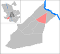
Barrio de Buenavista (116), Madrid.svg 1,654 × 1,590; 10 KB
-
Barrio de Comillas (111), Madrid.svg 1,654 × 1,590; 10 KB
-
Barrio de Opañel (112), Madrid.svg 1,654 × 1,590; 10 KB
-
Barrio de Puerta Bonita (115), Madrid.svg 1,654 × 1,590; 10 KB
-
Barrio de San Isidro (113), Madrid.svg 1,654 × 1,590; 10 KB
-
Barrio de Vista Alegre (114), Madrid.svg 1,654 × 1,590; 10 KB
-
Barrios del Distrito de Carabanchel (Madrid).svg 1,654 × 1,590; 71 KB
-
Carabanchel District loc-map (2).jpg 2,000 × 2,000; 272 KB
-
Carabanchel District loc-map.svg 527 × 527; 28 KB
-
Centros Culturales de Carabanchel.PNG 531 × 480; 35 KB
-
Comercio en Carabanchel.JPG 1,189 × 622; 98 KB
-
Comercio en Carabanchel.PNG 1,189 × 622; 66 KB
-
Comillas.PNG 552 × 498; 19 KB
-
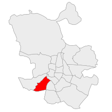
Distrito de Carabanchel (Madrid).svg 1,654 × 1,590; 10 KB
-
División distrito Carabanchel Alto y Bajo.PNG 189 × 114; 3 KB
-
Estaciones de Metro en Carabanchel.PNG 531 × 480; 45 KB
-
Evolución Carabanchel.PNG 1,187 × 255; 37 KB
-
Evolución de Carabanchel en Madrid.PNG 894 × 254; 24 KB
-
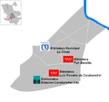
Localización bibliotecas de Carabanchel.PNG 531 × 500; 29 KB
-
Localización cementerios de Carabanchel.PNG 531 × 480; 25 KB
-
Localización principales zonas verdes Carabanchel.PNG 531 × 480; 24 KB
-
Mapa de Carabanchel reestructuración 1971.PNG 375 × 150; 9 KB
-
Maps - ES - Madrid - Carabanchel-barrios.png 531 × 480; 20 KB
-
Maps - ES - Madrid - Carabanchel.PNG 455 × 540; 14 KB
-
Opañel.PNG 552 × 498; 20 KB
-
Polideportivos de Carabanchel.PNG 531 × 480; 36 KB
-
Puerta bonita.PNG 552 × 498; 20 KB
-
San isidro.PNG 552 × 498; 20 KB
-
Servicio sanitario de Carabanchel.PNG 531 × 480; 64 KB
-
Vista alegre.PNG 552 × 498; 20 KB
-
Vías ciclistas de Carabanchel.PNG 544 × 534; 27 KB
-
Zonas verdes de Carabanchel.PNG 531 × 480; 25 KB

