Category:Images by Gwyn Jones
Jump to navigation
Jump to search

Media in category "Images by Gwyn Jones"
The following 153 files are in this category, out of 153 total.
-
 A Cold Morning in Walkhampton - geograph.org.uk - 85879.jpg 640 × 480; 76 KB
-
 A38 Flyover, Brixton - Plympton Road - geograph.org.uk - 66676.jpg 640 × 480; 96 KB
-
 Andron Woods, Hollacombe - geograph.org.uk - 55677.jpg 640 × 480; 179 KB
-
 Approach to Derriford Roundabout - geograph.org.uk - 85866.jpg 640 × 480; 134 KB
-

-
 Barn Farm - geograph.org.uk - 53832.jpg 640 × 480; 158 KB
-
 Bat's Head - geograph.org.uk - 55736.jpg 640 × 480; 95 KB
-
 Battle Remains, Lulworth Camp - geograph.org.uk - 51115.jpg 640 × 480; 123 KB
-
 Big Lock, Middlewich - geograph.org.uk - 51097.jpg 640 × 480; 129 KB
-
 Boston Shipyard, Oreston - geograph.org.uk - 64783.jpg 640 × 480; 99 KB
-
 Bournemouth Pier under Wave Attack - geograph.org.uk - 76584.jpg 640 × 480; 86 KB
-
 Bridge to Nowhere, Princetown Railway - geograph.org.uk - 58454.jpg 640 × 480; 149 KB
-

-
 Broad Ooze, River Yealm - geograph.org.uk - 80072.jpg 640 × 480; 96 KB
-
 Buckfast Chapel - geograph.org.uk - 83849.jpg 640 × 480; 149 KB
-
 Burrow Hill - geograph.org.uk - 55972.jpg 640 × 480; 78 KB
-
 Carland Cross Wind Farm - geograph.org.uk - 88927.jpg 640 × 480; 54 KB
-
 Carland Cross Wind Farm.jpg 626 × 462; 185 KB
-
 Carreg Ddu Reservoir - geograph.org.uk - 51106.jpg 480 × 640; 102 KB
-
 Cattle Grazing - Langerstone Point - geograph.org.uk - 76599.jpg 640 × 480; 101 KB
-
 Celtic Cross, Stentaway Road, Plymstock - geograph.org.uk - 58419.jpg 640 × 480; 140 KB
-
 Clapper Bridge and Ford, Abbot's Way - geograph.org.uk - 83847.jpg 640 × 480; 187 KB
-
 Clapper Bridge, River Avon, Dartmoor - geograph.org.uk - 86169.jpg 640 × 480; 60 KB
-
 Clearbrook Village - geograph.org.uk - 85874.jpg 640 × 480; 106 KB
-
 Coastal Erosion, Copstone Cove - geograph.org.uk - 76602.jpg 640 × 480; 132 KB
-
 Craig Goch Dam, Elan Valley - geograph.org.uk - 51104.jpg 640 × 480; 162 KB
-
 Crawl Woods, Newton Ferrors - geograph.org.uk - 80063.jpg 480 × 640; 133 KB
-
 Crazy Well Pool, Dartmoor - geograph.org.uk - 90803.jpg 640 × 480; 86 KB
-

-
 Devon Lane, Arcadia Elburton - geograph.org.uk - 55689.jpg 640 × 480; 188 KB
-

-
 Disused Track, Hawks Tor - geograph.org.uk - 55704.jpg 640 × 480; 130 KB
-
 Dorsmouth Rock Trig. Pillar - geograph.org.uk - 66649.jpg 640 × 480; 107 KB
-
 Double-headed Steam, Dainton Bank - geograph.org.uk - 55722.jpg 640 × 480; 64 KB
-
 Drake's Island - geograph.org.uk - 51145.jpg 640 × 480; 103 KB
-
 Drake's Leat, Roborough Down - geograph.org.uk - 85876.jpg 640 × 480; 166 KB
-
 Durdle Door - geograph.org.uk - 55738.jpg 640 × 480; 119 KB
-
 Eden Project Domes - geograph.org.uk - 66738.jpg 640 × 480; 74 KB
-
 Elender Cove, Gammon Head - geograph.org.uk - 76607.jpg 640 × 480; 127 KB
-
 End of the Line, Chittleburn - geograph.org.uk - 66669.jpg 640 × 480; 154 KB
-
 EWS Depot, Marsh Mills Sidings - geograph.org.uk - 79012.jpg 640 × 480; 173 KB
-
 Exeter Inn, Modbury - geograph.org.uk - 76586.jpg 640 × 480; 101 KB
-
 Ferry Cottage, Noss Mayo - geograph.org.uk - 80036.jpg 640 × 480; 113 KB
-
 Fishing Pond, Cadover Bridge - geograph.org.uk - 53858.jpg 640 × 480; 97 KB
-
 Foggintor Quarry - geograph.org.uk - 58424.jpg 640 × 480; 172 KB
-
 Formal Gardens, Mount Edgcumbe Park - geograph.org.uk - 51143.jpg 640 × 480; 173 KB
-
 Gdynia Way, Prince Rock, Plymouth - geograph.org.uk - 63643.jpg 640 × 480; 136 KB
-
 Giant Marble, Hart Tor Brook - geograph.org.uk - 90800.jpg 640 × 480; 86 KB
-
 Gwennap Pit, Busveal - geograph.org.uk - 88911.jpg 640 × 480; 167 KB
-
 GWR, Dawlish Warren - geograph.org.uk - 90825.jpg 480 × 640; 139 KB
-
 Hart Tor, Dartmoor - geograph.org.uk - 90789.jpg 640 × 480; 94 KB
-
 Head of Cofflete Creek, Brixton Torr - geograph.org.uk - 55696.jpg 640 × 480; 173 KB
-
 Hele Almshouses, Wembury - geograph.org.uk - 53850.jpg 640 × 480; 118 KB
-
 Hulk, Hooe Lake - geograph.org.uk - 64787.jpg 640 × 480; 145 KB
-

-
 Jennycliff Cafe, overlooking Plymouth Sound.jpg 640 × 480; 78 KB
-
 Jew's Wood - geograph.org.uk - 55969.jpg 640 × 480; 81 KB
-

-
 King George V's Playing Fields, Elburton - geograph.org.uk - 63647.jpg 640 × 480; 111 KB
-
 Kissing Gate, Plymouth - Yealmpton railway - geograph.org.uk - 66704.jpg 480 × 640; 204 KB
-
 Knowle Down - geograph.org.uk - 85881.jpg 640 × 480; 145 KB
-
 Laira Bridge, Plymouth - geograph.org.uk - 58416.jpg 640 × 480; 105 KB
-
 Landing Jetty, Drake's Island - geograph.org.uk - 85903.jpg 640 × 480; 118 KB
-
 Langdon Beach - geograph.org.uk - 53810.jpg 640 × 480; 131 KB
-
 Langdon Court - geograph.org.uk - 53840.jpg 640 × 480; 151 KB
-
 Lee Moor China Clay Works - geograph.org.uk - 53856.jpg 640 × 480; 70 KB
-
 Lyneham Inn, near Plympton - geograph.org.uk - 66706.jpg 640 × 480; 91 KB
-
 Maelcombe House - geograph.org.uk - 76590.jpg 640 × 480; 97 KB
-
 Manor Bourne, Andurn Brake - geograph.org.uk - 80058.jpg 640 × 480; 82 KB
-
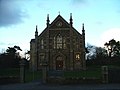
 Methodist Church, Ponsanooth - geograph.org.uk - 88904.jpg 640 × 480; 86 KB
-
 Middlewich Flash, Croxton Hall - geograph.org.uk - 51117.jpg 640 × 480; 114 KB
-
 Millennium Bridge - geograph.org.uk - 55762.jpg 640 × 480; 60 KB
-
 Mouthstone Point, River Yealm - geograph.org.uk - 80028.jpg 640 × 480; 78 KB
-
 Mud Flats, Cofflete Creek - geograph.org.uk - 55691.jpg 640 × 480; 113 KB
-
 Mudflats, River Yealm - geograph.org.uk - 66700.jpg 640 × 480; 138 KB
-
 Nant-y-moch Reservoir - geograph.org.uk - 51100.jpg 640 × 480; 95 KB
-
 Newnham Park - geograph.org.uk - 55701.jpg 640 × 480; 100 KB
-
 Newnham Park - geograph.org.uk - 58421.jpg 640 × 480; 100 KB
-
 Norsworthy Bridge - geograph.org.uk - 55709.jpg 640 × 480; 179 KB
-
 North Hessary TV Mast, Princetown - geograph.org.uk - 58446.jpg 480 × 640; 34 KB
-
 Outer Rocks, Prawle Point - geograph.org.uk - 76604.jpg 640 × 480; 108 KB
-
 Paige's Corner, Down Thomas - geograph.org.uk - 80067.jpg 640 × 480; 95 KB
-
 Parkstone Lane, Plympton - geograph.org.uk - 66682.jpg 640 × 480; 170 KB
-
 Peacock Meadow, Colebrook - geograph.org.uk - 53855.jpg 640 × 480; 159 KB
-
 Pig's Nose Inn, East Prawle - geograph.org.uk - 76598.jpg 640 × 480; 114 KB
-
 Plymouth Garden Centre, Bowden Battery - geograph.org.uk - 85864.jpg 640 × 480; 89 KB
-
 Plympton St Maurice - geograph.org.uk - 66678.jpg 640 × 480; 134 KB
-
 Polperro Harbour At Low Tide - geograph.org.uk - 55731.jpg 640 × 480; 166 KB
-
 Pont ar Elan, Elan Valley - geograph.org.uk - 51102.jpg 640 × 480; 113 KB
-
 Poole Head - geograph.org.uk - 55745.jpg 640 × 480; 76 KB
-
 Portreath Harbour Wall, Cornwall - geograph.org.uk - 51149.jpg 640 × 480; 88 KB
-
 Radford Quarry - geograph.org.uk - 64781.jpg 640 × 480; 128 KB
-

-
 Rape fields by moonlight, Warren Lane - geograph.org.uk - 80045.jpg 640 × 480; 117 KB
-
 Remains of the Demetrios, Prawle Point - geograph.org.uk - 76609.jpg 640 × 480; 102 KB
-
 River Avon at Huntingdon Cross - geograph.org.uk - 86172.jpg 640 × 480; 58 KB
-
 River Tamar at Saltash - geograph.org.uk - 51118.jpg 640 × 480; 79 KB
-
 River Wye Symonds Yat West - geograph.org.uk - 51110.jpg 640 × 480; 186 KB
-
 Road to Clearbrook, Roborough down - geograph.org.uk - 85872.jpg 640 × 480; 129 KB
-
 Roborough Down Trig Pillar - geograph.org.uk - 79010.jpg 640 × 480; 109 KB
-
 Salcombe Estuary - geograph.org.uk - 76605.jpg 640 × 480; 69 KB
-
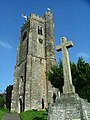
 Scorrier Church - geograph.org.uk - 90235.jpg 640 × 480; 72 KB
-
 Settling Lakes, Lee Moor China Clay Works - geograph.org.uk - 55707.jpg 640 × 480; 107 KB
-
 Sharpitor, Dartmoor - geograph.org.uk - 85884.jpg 640 × 480; 138 KB
-
 Sheeps Tor, Dartmoor - geograph.org.uk - 53861.jpg 640 × 480; 100 KB
-
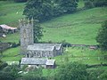 Sheepstor Church - geograph.org.uk - 66695.jpg 640 × 480; 115 KB
-
 Sheepstor Village - geograph.org.uk - 66698.jpg 640 × 480; 128 KB
-
 Shepherd and his Sheep, Pump Hill, Wembury - geograph.org.uk - 80070.jpg 640 × 480; 169 KB
-
 Sherford Valley.jpg 640 × 480; 111 KB
-
 Shipley Bridge, South Brent - geograph.org.uk - 79019.jpg 640 × 480; 179 KB
-
 Small Craft Moorings, Drake's Channel - geograph.org.uk - 85908.jpg 640 × 480; 63 KB
-
 Smockpark Lane - geograph.org.uk - 53822.jpg 640 × 480; 141 KB
-
 Spring, Walkhampton Common - geograph.org.uk - 58435.jpg 640 × 480; 149 KB
-
 St Aubyn Union Mine, nr St. Day - geograph.org.uk - 88914.jpg 480 × 640; 64 KB
-
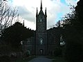
 St Mary's Church, Plympton - geograph.org.uk - 79013.jpg 480 × 640; 126 KB
-
 St. Mary's Church, Brixton - geograph.org.uk - 66685.jpg 480 × 640; 126 KB
-
 Staddiscombe Playing Fields - geograph.org.uk - 53853.jpg 640 × 480; 75 KB
-
 Staddiscombe Woods - geograph.org.uk - 55974.jpg 640 × 480; 183 KB
-
 Stag Lodge, Saltram - geograph.org.uk - 66643.jpg 640 × 480; 128 KB
-
 Stair Hole - geograph.org.uk - 55755.jpg 640 × 480; 166 KB
-
 Sutton High School for Boys, Regent Street - geograph.org.uk - 64790.jpg 640 × 480; 139 KB
-
 Tavy Bridge, near Plymouth - geograph.org.uk - 51157.jpg 640 × 480; 69 KB
-

-
 The Dartmoor Diner, Roborough - geograph.org.uk - 79007.jpg 640 × 480; 99 KB
-
 The George Hotel, Tavistock Road, Plymouth - geograph.org.uk - 85870.jpg 640 × 480; 101 KB
-
 The Mewstone, Wembury - geograph.org.uk - 51168.jpg 640 × 480; 54 KB
-
 The Mewstone, Wembury - geograph.org.uk - 55975.jpg 640 × 480; 74 KB
-
 The Mewstone, Wembury - geograph.org.uk - 55976.jpg 640 × 480; 52 KB
-
 The Odd Wheel, Wembury - geograph.org.uk - 53846.jpg 640 × 480; 115 KB
-
 The Older Church, St Day - geograph.org.uk - 88919.jpg 640 × 480; 84 KB
-
 The Origin of the Footpath, Castleton - geograph.org.uk - 66747.jpg 640 × 480; 155 KB
-
 Tidal Weir, River Yealm - geograph.org.uk - 66701.jpg 640 × 480; 96 KB
-
 Town Clock, St Day - geograph.org.uk - 88916.jpg 480 × 640; 68 KB
-
 Water Frontage, Newton Ferrers - geograph.org.uk - 80055.jpg 640 × 480; 110 KB
-
 Water Meadow, behind Wembury Beach. - geograph.org.uk - 63658.jpg 640 × 480; 140 KB
-
 Wembury Bus Terminal - In Snow - geograph.org.uk - 85889.jpg 640 × 480; 132 KB
-
 Wembury Trig - geograph.org.uk - 55682.jpg 480 × 640; 159 KB
-
 Wembury Woods - geograph.org.uk - 55687.jpg 640 × 480; 142 KB
-
 West Sherford Farm - geograph.org.uk - 66672.jpg 640 × 480; 162 KB
-
 West Wembury Farm - geograph.org.uk - 83846.jpg 640 × 482; 139 KB
-
 Westminster Cathedral - geograph.org.uk - 88894.jpg 640 × 480; 127 KB
-
 Wiverton Crossroads, Sherford Valley - geograph.org.uk - 66693.jpg 640 × 480; 143 KB
-
 Yellowmead Farm, near Princetown - geograph.org.uk - 58429.jpg 640 × 480; 131 KB
-
 Burncoose Gardens, nr Gwennap - geograph.org.uk - 88907.jpg 640 × 480; 185 KB
-
 Caban Coch Dam - geograph.org.uk - 55756.jpg 640 × 480; 153 KB
-
 Engine House, near Goonearl - geograph.org.uk - 88924.jpg 480 × 640; 53 KB
-
 Engine House, Wheal Rose - geograph.org.uk - 88922.jpg 480 × 640; 91 KB
-
 Goold's Engine House - geograph.org.uk - 51152.jpg 640 × 480; 85 KB
-
 Great Flat Lode - geograph.org.uk - 51136.jpg 640 × 480; 84 KB
-
 Penryn Quay - geograph.org.uk - 88901.jpg 640 × 480; 147 KB
-
 Royal William Yard - geograph.org.uk - 55714.jpg 640 × 480; 89 KB
-

-
 Winnats Pass - geograph.org.uk - 55757.jpg 640 × 480; 65 KB


