Category:Geography of Kawagoe, Saitama
Jump to navigation
Jump to search
日本語: 川越市の地理
Wikimedia category | |||||
| Upload media | |||||
| Instance of | |||||
|---|---|---|---|---|---|
| |||||
Subcategories
This category has the following 3 subcategories, out of 3 total.
Media in category "Geography of Kawagoe, Saitama"
The following 20 files are in this category, out of 20 total.
-
Isa-numa.JPG 2,048 × 1,536; 1.38 MB
-
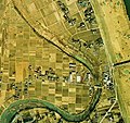
Kainuma-kawagoe-saitama-ckt-74-15 c10 10 t2.jpg 2,217 × 2,081; 1.71 MB
-
Kawagoe Arakawa Kamigobasi 1.jpg 640 × 480; 31 KB
-
Kawagoe Boating In Shingashi River 1.jpg 2,592 × 1,944; 2.72 MB
-
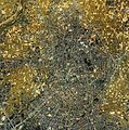
Kawagoe city center area Aerial photograph.1984.jpg 6,875 × 6,946; 38.7 MB
-
Kawagoe city center area Aerial photograph.2019.jpg 7,482 × 10,207; 55.73 MB
-
Kawagoe Furou River Drought 1.JPG 3,200 × 2,400; 2.3 MB
-
Kawagoe Furou River Most Downstream 1.JPG 2,592 × 1,944; 2.09 MB
-
Kawagoe Iruma River 1.JPG 3,264 × 2,448; 2.28 MB
-
Kawagoe Irumagawa Goryuten 1.jpg 640 × 480; 32 KB
-
Kawagoe Irumagawa Kamigobasi 1.jpg 640 × 480; 31 KB
-
Kawagoe Shingashi River Floodway 1.JPG 3,264 × 2,448; 1.88 MB
-
Kawagoe Takinumagawa Kamigobasi 1.jpg 640 × 480; 34 KB
-
Santomeshinden.jpg 410 × 319; 61 KB
-
Shimoshingashi.jpg 320 × 240; 70 KB
-
Shingashi-gawa -Kawagoe 01.jpg 2,272 × 1,704; 2.72 MB
-
Shingashi-gawa -Kawagoe 02.jpg 1,600 × 1,200; 1.06 MB
-
Ushiko-Kawagoe-Saitama-ckt-79-2 c8 5 t1.jpg 1,633 × 1,597; 1.03 MB
-
Ushikozeki.JPG 320 × 240; 52 KB
-
国土交通省河川事務所 - panoramio.jpg 4,160 × 2,336; 1.95 MB


