Category:Geißhorn
Jump to navigation
Jump to search
mountain of Allgäu Alps at border of Vorarlberg, Austria, and Bavaria, Germany | |||||
| Upload media | |||||
| Instance of | |||||
|---|---|---|---|---|---|
| Location |
| ||||
| Has part(s) |
| ||||
| Mountain range | |||||
| Topographic prominence |
| ||||
| Topographic isolation |
| ||||
| Elevation above sea level |
| ||||
| Different from | |||||
 | |||||
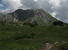
Deutsch: Das Geißhorn ist ein 2366 Meter hoher Berg in den Allgäuer Alpen auf der Grenze zwischen Deutschland und Österreich gelegen.
English: The Geißhorn (2366 m) is a mountain in the Allgäu Alps, on the border of Germany and Austria.
Media in category "Geißhorn"
The following 38 files are in this category, out of 38 total.
-
02.02 Wanderung zum Geißhorn 14.jpg 7,773 × 2,701; 3.5 MB
-
Aconitum napellus an der Braunarlspitze.JPG 3,264 × 2,448; 4.77 MB
-
Baerenkopf.jpg 1,024 × 743; 291 KB
-
Blick vom Geißhorn - 1. Tag (9800503456).jpg 3,680 × 936; 1.38 MB
-
Blick zum Geißhorn - 1. Tag (9800508746).jpg 3,584 × 792; 1.7 MB
-
Elferkopf von NO.jpg 1,474 × 986; 221 KB
-
Eselsweg Seehütte Geißhorn.jpg 4,000 × 3,000; 4.74 MB
-
Eselsweg Seehütte Widderstein.jpg 4,000 × 3,000; 4.48 MB
-
Fellbachtal Mohnenfluh.jpg 6,752 × 2,851; 6.52 MB
-
Geislinger, Jäger Steig Hochtannbergpass.JPG 4,272 × 2,848; 7.89 MB
-
Geisshorn Liechelkopf Elfer.JPG 3,264 × 2,448; 3.61 MB
-
Geisshorn vom Gemstelkoblach.JPG 3,264 × 2,448; 3.52 MB
-
Geisshorn.JPG 3,264 × 2,448; 3.47 MB
-
Geißhorn (2366m) - 1. Tag (9800472285).jpg 3,968 × 2,976; 1.73 MB
-
Geißhorn 2021a.jpg 4,000 × 3,000; 4.75 MB
-
Geißhorn 2021b.jpg 4,000 × 3,000; 4.78 MB
-
Geißhorn 2021c.jpg 4,000 × 3,000; 4.83 MB
-
Geißhorn mit Mindelheimer Hütte.jpg 3,264 × 2,448; 3.69 MB
-
Geißhorn vom Haldenwanger Eck aus - panoramio.jpg 3,872 × 2,592; 912 KB
-
Geißhorn von Osten.jpg 4,000 × 3,000; 4.73 MB
-
Geißhorn von Süden.jpg 3,000 × 4,000; 4.24 MB
-
Geißhorn, Haldenwanger Eck - panoramio.jpg 3,872 × 2,592; 1.08 MB
-
Geißhorn.jpg 1,174 × 783; 448 KB
-
Grenzstein 147 am südlichsten Punkt Deutschlands.jpg 3,872 × 2,592; 4.54 MB
-
Grenzstein Haldenwanger Eck - Blick nach Deutschland - panoramio.jpg 3,872 × 2,592; 5.55 MB
-
Grünhorn Allgäu Alps Summit at sunset.JPG 3,840 × 2,160; 2.38 MB
-
Grünhorn Allgäu Alps Summit cross.JPG 3,840 × 2,160; 1.67 MB
-
Kleiner Rappenkopf Rappensee.JPG 3,264 × 2,448; 4.26 MB
-
Mindelheimer Klettersteig Leiterbruecke02.JPG 3,264 × 2,448; 4.75 MB
-
Mittlere Rappenalpe 2020b.jpg 4,000 × 3,000; 4.46 MB
-
Panorama Rappenseehütte.jpg 11,202 × 2,955; 9.78 MB
-
Rappensee um.jpg 2,250 × 1,500; 2.55 MB
-
Rappenseehütte mit den beiden Rappenseen.jpg 3,264 × 2,448; 3.72 MB
-
Walser Geißhorn from North.JPG 4,000 × 3,000; 2.56 MB
-
Walser Geißhorn Summit cross.JPG 4,000 × 3,000; 2.04 MB
-
Widderstein from Hoeferspitze.JPG 3,648 × 2,736; 2.97 MB
-
Wildental mit Geißhorn.jpg 4,000 × 3,000; 4.73 MB
-
Zweiter Schafalpenkopf Liechelkopf Elfer.JPG 3,264 × 2,448; 4.4 MB


