Category:English-language map legends
Jump to navigation
Jump to search
Subcategories
This category has only the following subcategory.
M
- Map legends of Sanborn maps (27 F)
Media in category "English-language map legends"
The following 69 files are in this category, out of 69 total.
-
2015 Freedom Festival map - geograph.org.uk - 4652719.jpg 1,600 × 1,065; 385 KB
-
Baist Seattle 1905 legend - alt - raw.jpg 2,592 × 1,944; 651 KB
-
Biogeographical Regions Europe - Legend (en).png 2,272 × 1,910; 54 KB
-
Bulgaria landcover legend.png 1,679 × 1,739; 86 KB
-
Bulgaria landcover legend.svg 675 × 990; 704 KB
-
California county map legend.svg 700 × 918; 718 KB
-
Cambridge, MA Green Map Legend.png 288 × 345; 11 KB
-
China map legend.png 293 × 90; 4 KB
-
Cincinnati Bike Map Legend.png 1,198 × 910; 152 KB
-
Delta1141-727key.png 1,244 × 428; 38 KB
-
Ecozone-Biocountry-Afrotropic-legend.svg 175 × 290; 106 KB
-
Ecozone-Biocountry-Australasia-2-legend.svg 160 × 357; 114 KB
-
Ecozone-Biocountry-Australasia-legend.svg 112 × 95; 30 KB
-
Ecozone-Biocountry-Indomalaya-legend.svg 164 × 128; 39 KB
-
Ecozone-Biocountry-Neotropic-legend.svg 189 × 290; 105 KB
-
Ecozone-Biocountry-Palearctic-legend.svg 172 × 419; 5 KB
-
Ecozones Map Legend.svg 116 × 250; 63 KB
-
European location legend en.png 503 × 316; 12 KB
-
European location legend en.svg 503 × 316; 10 KB
-
Flags legend.gif 592 × 166; 6 KB
-
HDImaplegend current.png 249 × 478; 4 KB
-
India map disputed legend.svg 509 × 251; 55 KB
-
India map legend en.png 531 × 238; 7 KB
-
India map legend.svg 639 × 756; 87 KB
-
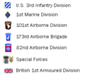
Iraq War 2003 legend.png 232 × 215; 5 KB
-
Iwo Jima Historical Map (Poster).jpg 2,370 × 3,584; 2.24 MB
-
Jinderboine 1898 cadastral map key.jpg 1,102 × 776; 157 KB
-
Kansas official transportation map legend.png 397 × 897; 218 KB
-
Key to maps of counties by JaqbS-en.svg 413 × 311; 184 KB
-
Landing Fields - Franch Indo China - - NARA - 68159405 (page 2).jpg 5,274 × 6,770; 5.26 MB
-
Legend (English) French municipality map.PNG 169 × 195; 3 KB
-
Legend (English) French municipality map.svg 169 × 195; 5 KB
-
Legend plate tectonic maps-en.png 930 × 383; 19 KB
-
Legend to the OpenTopo maps of Gemeentenatlas.png 1,012 × 1,765; 292 KB
-
Legenda plattegrond Anna's Tuin & Ruigte.jpg 4,032 × 3,024; 2.09 MB
-
Legende zu Locator Map Deutschland 1945.PNG 1,000 × 148; 13 KB
-
Map of Dogville (Lars von Trier).svg 1,020 × 497; 133 KB
-
Map of Manderlay Plantation (Lars von Trier).svg 1,682 × 661; 201 KB
-
Map reference detailing quality and extent of land (31396287663).jpg 3,253 × 4,020; 8.51 MB
-
Minnesota ten color palat september wiki version.jpeg 2,064 × 422; 107 KB
-
Mk Rotterdam Metro Legende.png 700 × 377; 8 KB
-
Ecozone-Biocountry-Nearctic-legend.svg 155 × 422; 146 KB
-
Ordnance Survey 1-250000 Legend 2010.jpg 2,545 × 3,951; 1,000 KB
-
Ordnance Survey 1-250000 Legend 2010.pdf 1,752 × 2,479; 2.01 MB
-
Ordnance Survey 1-250000 Legend 2010.tif 2,545 × 3,951; 1.98 MB
-
Playground Caribbean Map 1.jpg 4,032 × 3,024; 1.05 MB
-
Playground Caribbean Map 2.jpg 3,024 × 4,032; 982 KB
-
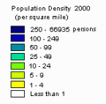
Population density key.png 185 × 93; 4 KB
-
Population map key.png 190 × 273; 6 KB
-
Tectonic plates - legend.png 188 × 182; 1 KB
-
Template of Military Symbols.png 2,020 × 3,287; 679 KB
-
Template of Military Symbols.svg 776 × 1,479; 2.1 MB
-
Toolbox SVG locator maps (location map based)-en.svg 962 × 848; 61 KB
-
Trap Legend.svg 640 × 413; 1 KB
-
Tutorial assemblate a map 2.jpg 550 × 446; 56 KB
-
Us map legend 1.svg 581 × 337; 10 KB
-
Us map legend.svg 360 × 427; 12 KB
-
USA 2000 population density key.jpg 170 × 173; 5 KB
-
USA 2000 population density key.png 159 × 157; 762 bytes
-
USA 2000 presidential popular vote by county key.jpg 191 × 167; 6 KB
-
USGS topomapsymbols.pdf 1,050 × 1,650, 4 pages; 2.06 MB
-
Washington electoral map key.svg 147 × 156; 77 KB
-
Westbankjan06. Legend.jpg 516 × 1,318; 185 KB
-
World copyright-terms key wide plain.svg 476 × 55; 3 KB
-
World Map Gini coefficient Legend.png 250 × 310; 3 KB
-
Worldmap UNPO Legend.png 259 × 274; 3 KB
-
Örnefnasrká legend.gif 171 × 275; 8 KB


