Category:Derry Hill
Jump to navigation
Jump to search
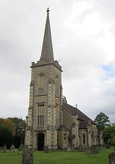
English: Derry Hill is a village in the English county of Wiltshire.
- Bowood— the heritage country manor house and landscape gardens of the Marquis and Marchioness of Lansdowne, is in Derry Hill.
village in United Kingdom | |||||
| Upload media | |||||
| Instance of | |||||
|---|---|---|---|---|---|
| Location | Calne Without, Wiltshire, South West England, England | ||||
 | |||||
Subcategories
This category has the following 4 subcategories, out of 4 total.
Media in category "Derry Hill"
The following 31 files are in this category, out of 31 total.
-
A342 at an entrance to Bowood - geograph.org.uk - 1183774.jpg 640 × 489; 166 KB
-
A342 heads north at Sandy Lane - geograph.org.uk - 1183842.jpg 640 × 491; 123 KB
-
A342 looking north - geograph.org.uk - 1175314.jpg 640 × 482; 145 KB
-
A342 looking south - geograph.org.uk - 1183727.jpg 640 × 487; 173 KB
-
A342 near Derry Hill - geograph.org.uk - 1183768.jpg 640 × 516; 141 KB
-
A342 north toward Derry Hill - geograph.org.uk - 1183742.jpg 640 × 529; 126 KB
-
A4 heading east near Derry Hill - geograph.org.uk - 1418043.jpg 640 × 539; 251 KB
-
Chippenham to Calne Cycle Path - geograph.org.uk - 225610.jpg 640 × 429; 73 KB
-
Cocklemore Brook, Geograph-4269433-by-Michael-Dibb.jpg 640 × 480; 162 KB
-
Derry Hill - Bristol 461 (AFB592V).JPG 1,366 × 910; 705 KB
-
Derry Hill - Bristol 508 (THU354G).JPG 1,366 × 910; 514 KB
-
Derry Hill - Golden Gates Tower.jpg 300 × 400; 19 KB
-
Derry Hill Cricket Football Club - geograph.org.uk - 1419703.jpg 640 × 505; 129 KB
-
Derry Hill Well - geograph.org.uk - 139075.jpg 640 × 474; 110 KB
-
Fields, near Derry Hill - geograph.org.uk - 381925.jpg 640 × 480; 76 KB
-
Gate House, Bowood Golf and Country Club - geograph.org.uk - 21363.jpg 640 × 480; 122 KB
-
Gateway to Bowood - geograph.org.uk - 1095805.jpg 640 × 425; 32 KB
-
Golden Gates at Bowood - geograph.org.uk - 460641.jpg 597 × 400; 49 KB
-
Path skirting Bowood Golf Course - geograph.org.uk - 460606.jpg 640 × 480; 137 KB
-
Pining away by the A4 - geograph.org.uk - 1418226.jpg 640 × 479; 124 KB
-
Playing field near Studley - geograph.org.uk - 1420586.jpg 640 × 464; 125 KB
-
Public Footpath, Derry Hill Farm - geograph.org.uk - 139082.jpg 640 × 470; 82 KB
-
Warning sign by the A4 - geograph.org.uk - 1418217.jpg 640 × 518; 154 KB
-
Bowood Park Golf Club - geograph.org.uk - 381928.jpg 640 × 450; 48 KB
-
Derry Hill Chapel - geograph.org.uk - 123203.jpg 640 × 481; 43 KB
-
Modern bridge over the A4 - geograph.org.uk - 283087.jpg 640 × 480; 105 KB


