Category:Cottingham, Northamptonshire
Jump to navigation
Jump to search
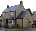
English: Cottingham is a village and civil parish in Northamptonshire in the English midlands that can trace its history back to Roman times. Cotingeham is listed in the Domesday Book and is also mentioned in the Anglo-Saxon Chronicle. It is located north-west of the town of Corby and is administered as part of that town's borough. At the time of the 2001 census, Cottingham parish's population was 912 people.
village and civil parish in Northamptonshire, United Kingdom | |||||
| Upload media | |||||
| Instance of | |||||
|---|---|---|---|---|---|
| Location | North Northamptonshire, Northamptonshire, East Midlands, England | ||||
| Population |
| ||||
 | |||||
Subcategories
This category has the following 3 subcategories, out of 3 total.
Media in category "Cottingham, Northamptonshire"
The following 78 files are in this category, out of 78 total.
-
A trough on The Hill - geograph.org.uk - 310834.jpg 640 × 480; 127 KB
-
Caravan Club site, Cottingham - geograph.org.uk - 1835019.jpg 3,648 × 2,736; 2.11 MB
-
Church House, Cottingham (geograph 7168932).jpg 1,024 × 755; 140 KB
-
Church Street, Cottingham (geograph 7167792).jpg 1,024 × 768; 167 KB
-
Corby Road between Corby and Cottingham - geograph.org.uk - 6196734.jpg 1,920 × 1,280; 1.21 MB
-
Corby Road between Corby and Cottingham - geograph.org.uk - 6196739.jpg 1,848 × 1,162; 1.23 MB
-
Corby Road, Cottingham - geograph.org.uk - 6196723.jpg 1,920 × 1,280; 1.24 MB
-
Cottingham from the Jurassic Way - geograph.org.uk - 1835732.jpg 3,648 × 2,736; 2.17 MB
-
Cottingham Parish Church - geograph.org.uk - 5176574.jpg 480 × 640; 54 KB
-
Cottingham Pocket Park - geograph.org.uk - 1946157.jpg 3,456 × 2,304; 4.6 MB
-
Cottingham village - geograph.org.uk - 6195737.jpg 1,920 × 1,280; 1.11 MB
-
Cottingham village - geograph.org.uk - 6195746.jpg 1,920 × 1,280; 1.15 MB
-
Cottingham village - geograph.org.uk - 6458014.jpg 1,920 × 1,280; 1.22 MB
-
Cottingham village sign - geograph.org.uk - 1835750.jpg 2,736 × 3,648; 2.16 MB
-
Farm building - geograph.org.uk - 397714.jpg 640 × 427; 151 KB
-
Gates near to Middleton - geograph.org.uk - 310840.jpg 640 × 480; 92 KB
-
Harborough Road at the junction of Corby Road - geograph.org.uk - 6196732.jpg 1,920 × 1,280; 1.45 MB
-
Horses by The Hill - geograph.org.uk - 310872.jpg 640 × 480; 115 KB
-
Houses in Cottingham - geograph.org.uk - 6196714.jpg 1,920 × 1,280; 1.38 MB
-
Pipewell Wood. - geograph.org.uk - 438944.jpg 640 × 480; 146 KB
-
River Welland flowing from the West - geograph.org.uk - 310904.jpg 640 × 396; 43 KB
-
Rockingham Castle Horse Trials, showjumping - geograph.org.uk - 4152954.jpg 1,600 × 1,192; 367 KB
-
Rockingham Castle Horse Trials, showjumping arena - geograph.org.uk - 4247343.jpg 4,493 × 2,241; 2.69 MB
-
Rockingham Castle, aerial 2017 - geograph.org.uk - 5436388.jpg 1,024 × 683; 147 KB
-
Royal George, Cottingham.jpg 2,040 × 1,318; 774 KB
-
School Lane, Cottingham - geograph.org.uk - 6383055.jpg 1,880 × 1,218; 1.79 MB
-
Shire Horses at Rockingham Castle Horse Trials - geograph.org.uk - 4152958.jpg 1,456 × 1,600; 601 KB
-
Still there - geograph.org.uk - 5540319.jpg 3,648 × 2,736; 2.75 MB
-
The Green - geograph.org.uk - 590519.jpg 640 × 427; 61 KB
-
The Rutland Flyer - geograph.org.uk - 564277.jpg 640 × 532; 177 KB
-
View over Cottingham - geograph.org.uk - 4646746.jpg 640 × 480; 63 KB
-
Welcome to Cottingham - geograph.org.uk - 564225.jpg 640 × 371; 112 KB
-
Welcome to Cottingham - geograph.org.uk - 564294.jpg 640 × 434; 126 KB
-
A house on The Hill in Middleton - geograph.org.uk - 310832.jpg 640 × 544; 93 KB
-
Barn next to the B670 - geograph.org.uk - 377937.jpg 640 × 480; 42 KB
-
Barrier on Bridleway. - geograph.org.uk - 428708.jpg 640 × 480; 157 KB
-
Bridge on the Bridleway. - geograph.org.uk - 428732.jpg 640 × 480; 181 KB
-
Bridge over Ditch. - geograph.org.uk - 428724.jpg 640 × 480; 184 KB
-
Church Street, Cottingham - geograph.org.uk - 300866.jpg 640 × 480; 72 KB
-
Climate Change^ - geograph.org.uk - 428730.jpg 640 × 480; 173 KB
-
Cottingham, Northamptonshire - geograph.org.uk - 564269.jpg 640 × 459; 124 KB
-
Country Road. - geograph.org.uk - 428738.jpg 640 × 480; 76 KB
-
Danesholme Junior School - geograph.org.uk - 348753.jpg 640 × 427; 160 KB
-
Entrance to Blackthorn Wood Golf Club - geograph.org.uk - 310925.jpg 640 × 480; 58 KB
-
Farm track - geograph.org.uk - 488259.jpg 640 × 480; 57 KB
-
Farm Track beside the Wheat Fields.. - geograph.org.uk - 428741.jpg 640 × 480; 105 KB
-
Farm Track in Spring Bloom. - geograph.org.uk - 428678.jpg 640 × 480; 156 KB
-
Farmland west of Corby - geograph.org.uk - 497440.jpg 640 × 428; 99 KB
-
Footpath beside hedge - geograph.org.uk - 488262.jpg 640 × 480; 38 KB
-
Forest Lodge - geograph.org.uk - 351514.jpg 640 × 427; 109 KB
-
GPS for gates^^^ - geograph.org.uk - 488244.jpg 640 × 480; 58 KB
-
Junction of Danesholme Road and A6003 - geograph.org.uk - 348768.jpg 640 × 427; 173 KB
-
Kingswood lower school - geograph.org.uk - 350023.jpg 640 × 427; 251 KB
-
Kingswood upper school - geograph.org.uk - 350021.jpg 640 × 427; 258 KB
-
Little Used Footpath. - geograph.org.uk - 428680.jpg 640 × 480; 159 KB
-
Middleton through some gates - geograph.org.uk - 310857.jpg 640 × 480; 89 KB
-
North-west corner of Rockingham Park - geograph.org.uk - 377928.jpg 640 × 480; 114 KB
-
Refreshing Drink from Harper's Brook. - geograph.org.uk - 428744.jpg 640 × 480; 168 KB
-
Remains of a Fallen Tree. - geograph.org.uk - 428714.jpg 640 × 480; 147 KB
-
Road to Woodlands Farm. - geograph.org.uk - 438930.jpg 640 × 480; 93 KB
-
Rural Track. - geograph.org.uk - 428672.jpg 640 × 480; 153 KB
-
School Hill Middleton - geograph.org.uk - 310836.jpg 640 × 520; 77 KB
-
School Hill, Middleton, from the top - geograph.org.uk - 310874.jpg 619 × 640; 113 KB
-
Spring Bloom. - geograph.org.uk - 428691.jpg 640 × 480; 153 KB
-
The Edge of Swinawe Wood. - geograph.org.uk - 428719.jpg 640 × 480; 107 KB
-
Trim trail at Danesholme Junior School - geograph.org.uk - 348756.jpg 640 × 427; 180 KB
-
Undisturbed Pond. - geograph.org.uk - 428698.jpg 640 × 480; 176 KB
-
View across the Wheat Field. - geograph.org.uk - 428700.jpg 640 × 480; 87 KB
-
View towards Water Tower. - geograph.org.uk - 428687.jpg 640 × 480; 110 KB
-
Waterworks entrance - geograph.org.uk - 310938.jpg 640 × 441; 70 KB
-
Woodland Hide. - geograph.org.uk - 438939.jpg 640 × 480; 180 KB
-
Woodlands Farm. - geograph.org.uk - 438937.jpg 640 × 480; 97 KB


