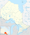
Category:Census divisions of Ontario
Jump to navigation
Jump to search
census division used by Statistics Canada to aggregate census data | |||||
| Upload media | |||||
| Subclass of | |||||
|---|---|---|---|---|---|
| Location |
| ||||
| |||||
Subcategories
This category has the following 6 subcategories, out of 6 total.
Media in category "Census divisions of Ontario"
The following 8 files are in this category, out of 8 total.
-
Canada Ontario location map 2.svg 2,032 × 2,314; 1.4 MB
-
Canada Ontario location map.svg 2,032 × 2,314; 1.31 MB
-
Canada Ontario relief location map.jpg 2,100 × 2,392; 2.75 MB
-
Canada Southern Ontario location map 2.png 994 × 717; 296 KB
-
Canada Southern Ontario location map.png 994 × 717; 245 KB
-
Canada Southern Ontario relief location map.jpg 1,043 × 752; 231 KB
-
Ontario, Canada location map.svg 2,032 × 2,314; 890 KB
-
Ontariocensusdivisions.PNG 436 × 780; 25 KB


