Category:Cartography of the United States
Jump to navigation
Jump to search
Countries of North America: Canada · Costa Rica · Cuba · El Salvador · Guatemala · Honduras · Mexico · Nicaragua · Panama · United States of America‡
‡: partly located in North America
‡: partly located in North America
maps of the New World | |||||
| Upload media | |||||
| Instance of | |||||
|---|---|---|---|---|---|
| Main subject | |||||
| |||||
Subcategories
This category has the following 3 subcategories, out of 3 total.
C
M
Media in category "Cartography of the United States"
The following 7 files are in this category, out of 7 total.
-
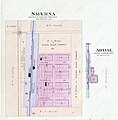
Smyrna and Abdal, Nuckolls County, Nebraska, USA. 1900.jpg 1,093 × 1,111; 613 KB
-
The New Yorker’s Map of the United States.jpg 767 × 976; 315 KB
-
Topographical Map of Eastern Hawaiʻi (951d8ea4-7b70-42cb-804f-d0896efee991).tif 5,953 × 4,722; 69.97 MB
-
Topographical Map of Eastern Hawaiʻi (aaf6e251-d95e-452c-bddd-710a9f3b1996).tif 2,974 × 1,783; 10.14 MB
-
US-Canadian border along the 49th parallel.png 2,108 × 708; 64 KB


