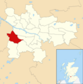
Category:Cardonald
Jump to navigation
Jump to search
suburb of Glasgow, Scotland, UK | |||||
| Upload media | |||||
| Instance of | |||||
|---|---|---|---|---|---|
| Location | Glasgow City, Scotland | ||||
| Different from | |||||
 | |||||
Subcategories
This category has the following 9 subcategories, out of 9 total.
C
- Cardonald Cemetery (1 F)
- Cardonald Parish Church (2 F)
- Cardonald railway station (22 F)
- Craigton Cemetery (17 F)
G
M
- Moss Heights (8 F)
- Mosspark railway station (8 F)
P
Media in category "Cardonald"
The following 50 files are in this category, out of 50 total.
-
Aros Drive - geograph.org.uk - 1322164.jpg 640 × 480; 109 KB
-
Ashkirk Drive (geograph 3720084).jpg 640 × 373; 110 KB
-
Bellahouston Park - geograph.org.uk - 573990.jpg 640 × 480; 91 KB
-
Berryknowes Road - geograph.org.uk - 2035898.jpg 640 × 480; 122 KB
-
Berryknowes Road - geograph.org.uk - 4562018.jpg 2,048 × 1,536; 711 KB
-
Block of flats on Berryknowes Road - geograph.org.uk - 5728916.jpg 1,600 × 1,162; 334 KB
-
Blocks of flats, Kelhead Path (geograph 6026854).jpg 1,210 × 1,600; 411 KB
-
Blocks of flats, Tinwald Path (geograph 6026803).jpg 1,600 × 1,134; 335 KB
-
Cardonald Bowling Club, Glasgow (geograph 3522945).jpg 5,184 × 3,456; 6.51 MB
-
Cardonald Crocuses - geograph.org.uk - 138030.jpg 640 × 480; 177 KB
-
Cardonald Library (geograph 6026784).jpg 1,600 × 1,092; 399 KB
-
Cardonald Medical Centre - geograph.org.uk - 1188926.jpg 640 × 480; 119 KB
-
Chirnside Road - geograph.org.uk - 1364883.jpg 640 × 480; 97 KB
-
Exterieur van Craigton House nabij Glasgow, RP-F-2001-7-426-30.jpg 8,270 × 5,598; 5.13 MB
-
Footbridge, Cardonald (geograph 3434903).jpg 640 × 480; 273 KB
-
Glasgow wards 2017 no04 Cardonald.png 2,000 × 2,040; 504 KB
-
High Flats, South Cardonald, Glasgow (geograph 3522908).jpg 5,184 × 3,456; 7.47 MB
-
Highrise flats in Cardonald in 2009.jpg 480 × 640; 120 KB
-
Hillington East railway station (geograph 2058458).jpg 480 × 640; 121 KB
-
Houses on Paisley Road West - geograph.org.uk - 1188929.jpg 640 × 480; 115 KB
-
Houses on Tweedsmuir Road (geograph 5322623).jpg 1,600 × 1,095; 286 KB
-
Housing in Montrave Street Cardonald (geograph 2302269).jpg 640 × 480; 135 KB
-
Ladykirk Drive - geograph.org.uk - 1545687.jpg 640 × 480; 77 KB
-
Last tower block demolition - geograph.org.uk - 4689146.jpg 1,281 × 1,638; 405 KB
-
Lourdes Secondary School, South Cardonald, Glasgow (geograph 3522919).jpg 5,184 × 3,456; 7.59 MB
-
Lourdes- 2014-04-03 22-25.jpg 5,184 × 3,456; 7.74 MB
-
Map of Glasgow and its Environs OS Map name 005-12, Ordnance Survey, 1857-1893.png 11,310 × 7,549; 13.1 MB
-
Map of Renfrewshire Sheet 012, Ordnance Survey, 1863-1864.jpg 10,706 × 7,173; 15.2 MB
-
Map of Renfrewshire Sheet 012, Ordnance Survey, 1863-1864.tiff 10,706 × 7,173; 219.71 MB
-
Moss Heights - geograph.org.uk - 5314057.jpg 1,600 × 1,072; 264 KB
-
Mosspark Drive (geograph 6246803).jpg 1,600 × 1,088; 487 KB
-
Muirdrum Avenue (geograph 4651344).jpg 3,504 × 2,336; 3.34 MB
-
Paisley Road West shops - geograph.org.uk - 1188930.jpg 640 × 480; 123 KB
-
Queensland Court - geograph.org.uk - 1545707.jpg 640 × 480; 55 KB
-
Queensland Drive - geograph.org.uk - 1364892.jpg 640 × 480; 72 KB
-
Queensland Gardens (geograph 3434775).jpg 640 × 480; 280 KB
-
South View of Berryknowes Road From Outside Cardonald Railway Station (geograph 6799450).jpg 6,720 × 4,480; 6.29 MB
-
Sunday Mail Building Cardonald Glasgow - panoramio (cropped).jpg 1,639 × 1,229; 813 KB
-
Sunday Mail Building Cardonald Glasgow - panoramio (zoomed).jpg 2,137 × 1,603; 1.58 MB
-
Sunday Mail Building Cardonald Glasgow - panoramio.jpg 3,072 × 2,304; 3.07 MB
-
The A761 to Paisley (geograph 3447850).jpg 4,149 × 3,084; 4.04 MB
-
Tower block demolition (geograph 4651322).jpg 2,323 × 3,096; 2.5 MB
-
Tower Block UK photo glw1-17 0 (Halfway 1983).jpg 2,626 × 1,731; 758 KB
-
Tower Block UK photo glw2-36 (Queensland Court 1981).jpg 2,623 × 1,718; 613 KB
-
Tower Block UK photo glw2-38 (Moss Heights 1983).jpg 2,623 × 1,726; 780 KB
-
Tower blocks, Cardonald - geograph.org.uk - 6187718.jpg 1,397 × 1,600; 391 KB
-
Tower Flats, Cardonald (geograph 2368294).jpg 3,648 × 2,736; 6.83 MB
-
Tree-lined pavement by Berryknowes Road - geograph.org.uk - 1188914.jpg 640 × 480; 154 KB
-
White Cart Water Near Mosspark Station - geograph.org.uk - 138010.jpg 640 × 480; 124 KB


