Category:Cambuslang
Jump to navigation
Jump to search
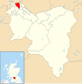
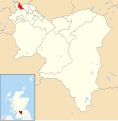
English: Cambuslang is a town in South Lanarkshire, Scotland.
town in South Lanarkshire, Scotland, UK | |||||
| Upload media | |||||
| Instance of | |||||
|---|---|---|---|---|---|
| Location |
| ||||
| Population |
| ||||
 | |||||
Cambuslang was a Civil Parish.
Subcategories
This category has the following 23 subcategories, out of 23 total.
A
- Auchenshuggle Bridge (7 F)
C
- Cambuslang Institute (5 F)
- Cambuslang railway station (25 F)
- Cambuslang Rangers F.C. (41 F)
- Clydeford Road Bridge (6 F)
D
E
F
G
- Gilbertfield Tower (1 P, 9 F)
H
- Halfway, South Lanarkshire (19 F)
K
- Gerard Killen (4 F)
M
- Tommy McAvoy (8 F)
N
P
T
W
Media in category "Cambuslang"
The following 121 files are in this category, out of 121 total.
-
A house in Cambuslang.jpg 2,736 × 3,648; 2.02 MB
-
Abandoned Cottage (3220157020).jpg 500 × 375; 117 KB
-
Allison Drive (geograph 2482627).jpg 640 × 480; 234 KB
-
Bin day, Cambuslang - geograph.org.uk - 2482635.jpg 640 × 480; 370 KB
-
Bogleshole Road Bridge. - geograph.org.uk - 962077.jpg 640 × 480; 65 KB
-
Bridge Street, Cambuslang (geograph 7873375).jpg 1,024 × 768; 373 KB
-
Cambulang from the south with Parish Kirk.jpg 1,605 × 1,075; 251 KB
-
Cambus Court Hotel - geograph.org.uk - 2485066.jpg 640 × 480; 327 KB
-
Cambuslang 005.JPG 2,288 × 1,712; 945 KB
-
Cambuslang Baptist Church (geograph 1698009).jpg 640 × 480; 74 KB
-
Cambuslang Credit Union - geograph.org.uk - 3674595.jpg 640 × 480; 153 KB
-
Cambuslang East.svg 1,319 × 1,345; 2.63 MB
-
Cambuslang from the air (geograph 4517259) (burnside).jpg 347 × 260; 88 KB
-
Cambuslang from the air (geograph 4517259) (rglen sth).jpg 483 × 362; 149 KB
-
Cambuslang from the air (geograph 4517259).jpg 640 × 480; 221 KB
-
Cambuslang from the air (geograph 5374281) (eastfield).jpg 326 × 245; 62 KB
-
Cambuslang from the air (geograph 5374281).jpg 640 × 480; 189 KB
-
Cambuslang Industrial Estate (geograph 2952701).jpg 640 × 481; 67 KB
-
Cambuslang Karting - geograph.org.uk - 1230024.jpg 640 × 480; 115 KB
-
Cambuslang RFC - geograph.org.uk - 729505.jpg 640 × 426; 41 KB
-
Cambuslang Subscription School.JPG 576 × 228; 63 KB
-
Cambuslang Town Centre.jpg 1,687 × 1,063; 327 KB
-
Cambuslang West.svg 1,319 × 1,345; 2.63 MB
-
Cambuslang.ogg 2.0 s; 35 KB
-
CambuslangMap1923.jpg 743 × 580; 102 KB
-
Carmyle and the east end from the air (geograph 2987415).jpg 640 × 480; 177 KB
-
Church, Brownside Road (geograph 2990302).jpg 640 × 480; 319 KB
-
Clyde between Cambuslang and Carmyle - geograph.org.uk - 1321997.jpg 640 × 480; 110 KB
-
Clyde Walkway and Cycle Route No. 75 - geograph.org.uk - 1359086.jpg 640 × 480; 150 KB
-
Clydebridge 2016.jpg 5,152 × 3,888; 5.08 MB
-
Clydebridge M74.jpg 12,544 × 1,792; 6.43 MB
-
Colliery site, Loanend - geograph.org.uk - 4265610.jpg 800 × 600; 523 KB
-
Croft Road crossing railway, Cambuslang (geograph 6966657).jpg 1,024 × 693; 139 KB
-
Dalbeth etc 008.JPG 1,712 × 2,288; 760 KB
-
Directions on cycle path by River Clyde - geograph.org.uk - 1359082.jpg 640 × 480; 158 KB
-
Disused works by the M74 (geograph 2777459).jpg 640 × 430; 58 KB
-
Dry stone wall superseded by fence - geograph.org.uk - 1605058.jpg 480 × 640; 125 KB
-
Eastfield Building.jpg 3,264 × 2,448; 3.64 MB
-
Exterieur van Rosebank House nabij Glasgow, RP-F-2001-7-426-85.jpg 5,120 × 8,270; 3.67 MB
-
Exterieur van Wellshot House nabij Glasgow, RP-F-2001-7-426-95.jpg 5,120 × 8,270; 3.63 MB
-
Exterieur van Westburn House nabij Glasgow, RP-F-2001-7-426-96.jpg 5,120 × 8,270; 3.57 MB
-
Flemington Farm ( approach ).jpg 4,688 × 2,897; 2.75 MB
-
Flemington Farm ( distant view ).jpg 4,687 × 2,897; 3.29 MB
-
Flemington Farm ( Front Elevation ).jpg 4,531 × 3,019; 3.47 MB
-
Flemington Farm ( side ).jpg 4,506 × 2,785; 2.47 MB
-
Flemington Farm.jpg 2,658 × 3,987; 2.41 MB
-
Gilbertfield Royal Observer Corps Post - geograph.org.uk - 34577.jpg 640 × 445; 125 KB
-
Gilbertfield Royal Observer Corps Post - geograph.org.uk - 66014.jpg 640 × 480; 139 KB
-
Glasgow Road (geograph 1854643).jpg 2,272 × 1,704; 874 KB
-
Glasgow Road, Cambuslang (geograph 4120982).jpg 1,600 × 1,067; 486 KB
-
Glasgow Rutherglen ScottishParliamentConstituency.svg 162 × 143; 18 KB
-
Grassland, Flemington - geograph.org.uk - 2990276.jpg 640 × 480; 285 KB
-
Green, Cambuslang Golf Club - geograph.org.uk - 2482620.jpg 640 × 480; 276 KB
-
Greenlees Old Tollhouse - geograph.org.uk - 4121377.jpg 5,184 × 3,456; 7.15 MB
-
Greenlees Road, Cambuslang, looking East - geograph.org.uk - 2583329.jpg 4,000 × 3,000; 5.94 MB
-
Greenleeshill from the air (geograph 5379548).jpg 640 × 445; 140 KB
-
Hallside farmland (derelict) (2) - geograph.org.uk - 4875862.jpg 1,024 × 683; 95 KB
-
Hallside lands - geograph.org.uk - 4875858.jpg 1,024 × 683; 161 KB
-
Hallside Newhouse farm (Derelict) - geograph.org.uk - 4875735.jpg 1,024 × 683; 128 KB
-
Hamilton Road - geograph.org.uk - 1230036.jpg 640 × 480; 115 KB
-
Hawthorn Walk, Cambuslang - geograph.org.uk - 2482642.jpg 640 × 480; 259 KB
-
Heading towards a railway bridge - geograph.org.uk - 3729681.jpg 640 × 480; 57 KB
-
Heron Taking off In Holmhills Wood Community park in Cambuslang.png 179 × 320; 115 KB
-
Hoover, Cambuslang - geograph.org.uk - 1304504.jpg 640 × 480; 97 KB
-
Hoover, Cambuslang - geograph.org.uk - 1321986.jpg 640 × 480; 96 KB
-
Howieshill Road - geograph.org.uk - 1230044.jpg 640 × 480; 112 KB
-
James Kelly MSP, May 2016.jpg 2,808 × 3,744; 947 KB
-
Keir's Walk.jpg 3,968 × 2,976; 4.46 MB
-
Kirkhill Golf Club - 11th Hole - geograph.org.uk - 3721292.jpg 640 × 480; 101 KB
-
Kirkhill Golf Club - Clubhouse - geograph.org.uk - 3721272.jpg 640 × 480; 78 KB
-
Kirkhill Golf Club - geograph.org.uk - 2977542.jpg 640 × 480; 292 KB
-
Kirkhill Golf Club - geograph.org.uk - 4121363.jpg 5,184 × 3,456; 7.73 MB
-
Kirkhill Golf Club - geograph.org.uk - 99654.jpg 640 × 480; 92 KB
-
Kyle Court (geograph 2485057).jpg 640 × 480; 262 KB
-
Looking north on the A749 (geograph 3440551).jpg 640 × 481; 51 KB
-
Map of Glasgow and its Environs OS Map name 010-08, Ordnance Survey, 1857-1893.png 11,392 × 7,548; 8.2 MB
-
Map of Glasgow and its Environs OS Map name 011-05, Ordnance Survey, 1857-1893.png 11,355 × 7,581; 20.68 MB
-
Map of Lanarkshire Sheet 011, Ordnance Survey, 1863-1865.jpg 10,704 × 7,164; 11.89 MB
-
Map of Lanarkshire Sheet 011, Ordnance Survey, 1863-1865.tiff 10,704 × 7,164; 219.39 MB
-
Monumental sculptor, Cambuslang - geograph.org.uk - 3674557.jpg 640 × 377; 132 KB
-
Morrisons, Cambuslang - geograph.org.uk - 1359067.jpg 640 × 480; 144 KB
-
National Cycle Route 756 near East Kilbride (geograph 7504641).jpg 1,024 × 768; 309 KB
-
Newton and Cambuslang from the air (geograph 2988822).jpg 640 × 480; 190 KB
-
Open area off Vicarland Road - geograph.org.uk - 3481173.jpg 640 × 480; 121 KB
-
OS old series Scotland 1 63360 31 (cropped).jpg 1,944 × 1,522; 743 KB
-
Railway bridge over Hamilton Road - geograph.org.uk - 1230043.jpg 640 × 480; 138 KB
-
Railway passes beneath Croft Road - geograph.org.uk - 1230040.jpg 640 × 480; 125 KB
-
Retail premises, Clydeford Road - geograph.org.uk - 2485051.jpg 640 × 480; 246 KB
-
River Clyde - geograph.org.uk - 2484829.jpg 640 × 480; 242 KB
-
Road to Helenslea Cottage - geograph.org.uk - 3440549.jpg 640 × 481; 64 KB
-
Salvation Army, Eastfield.jpg 3,264 × 2,448; 3.9 MB
-
Simian Conundrum, Flemington - geograph.org.uk - 137990.jpg 640 × 480; 104 KB
-
Site of former South Lanarkshire College - geograph.org.uk - 1230041.jpg 640 × 480; 118 KB
-
South Lanarkshire - 4 Central Avenue, Cambuslang, Glasgow - 20240920114843.jpg 4,000 × 3,000; 5.13 MB
-
South Lanarkshire - 4 Central Avenue, Cambuslang, Glasgow - 20240920114855.jpg 4,000 × 3,000; 5.81 MB
-
South Lanarkshire - 5 Beech Avenue, Central Avenue, Cambuslang, Glasgow - 20240920114920.jpg 4,000 × 3,000; 5.58 MB
-
South Lanarkshire - 5 Beech Avenue, Central Avenue, Cambuslang, Glasgow - 20240920114929.jpg 4,000 × 3,000; 3.18 MB
-
South Lanarkshire - 5 Beech Avenue, Central Avenue, Cambuslang, Glasgow - 20240920115005.jpg 4,000 × 3,000; 6.24 MB
-
Steelworks by the M74 (geograph 4243868).jpg 640 × 462; 42 KB
-
Sunderland v Cambuslang, 8 September 1888.jpg 742 × 382; 142 KB
-
Sunny Cambuslang 008.JPG 2,288 × 1,712; 873 KB
-
Sunny Cambuslang 011.JPG 2,279 × 1,270; 748 KB
-
The Cambuslang bank of the Clyde - geograph.org.uk - 2484836.jpg 640 × 480; 361 KB
-
Total Impact Fighting Fitness Gym, Hamilton Road, Cambuslang - geograph.org.uk - 4120994.jpg 5,184 × 3,456; 7.36 MB
-
Trig Point on Kirkhill Golf Course - geograph.org.uk - 3721287.jpg 640 × 480; 92 KB
-
Trig point, Manse Brae (2) - geograph.org.uk - 4875808.jpg 1,024 × 683; 300 KB
-
View across Glasgow - geograph.org.uk - 1230047.jpg 480 × 640; 133 KB
-
View to Back o'Hill - geograph.org.uk - 4875774.jpg 1,024 × 683; 150 KB
-
Warning flagpole - geograph.org.uk - 1605060.jpg 480 × 640; 53 KB
-
West Coats Primary School (geograph 2990324).jpg 640 × 480; 62 KB
-
West Greenlees - geograph.org.uk - 2981375.jpg 640 × 480; 264 KB
-
Westburn Cemetery, Cambuslang (geograph 7228153).jpg 1,024 × 768; 305 KB
-
Westburn Cemetery, Cambuslang - geograph.org.uk - 131900.jpg 640 × 480; 90 KB
-
Westcoats.JPG 2,243 × 1,557; 481 KB
-
Woodland, Kirkhill Golf Club - geograph.org.uk - 2981388.jpg 640 × 480; 367 KB
-
Kirkhill Golf Course - geograph.org.uk - 99666.jpg 640 × 480; 104 KB


