Category:Barton-upon-Humber photographs taken on 2010-02-14
Jump to navigation
Jump to search
Media in category "Barton-upon-Humber photographs taken on 2010-02-14"
The following 13 files are in this category, out of 13 total.
-

-
 Beacon Hill, near Barton - geograph.org.uk - 1713020.jpg 640 × 471; 223 KB
-
 East of Brigg Road, Barton - geograph.org.uk - 1713015.jpg 640 × 441; 219 KB
-
 Horkstow Road, near Barton - geograph.org.uk - 1713105.jpg 549 × 640; 196 KB
-
 Humber Bridge at dusk - geograph.org.uk - 1713085.jpg 640 × 455; 194 KB
-
 Near Barton Field Farm - geograph.org.uk - 1713063.jpg 449 × 640; 169 KB
-
 North of Horkstow Road, near Barton - geograph.org.uk - 1713107.jpg 640 × 472; 201 KB
-
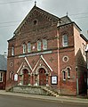 Salvation Army Citadel, Queen Street - geograph.org.uk - 1710649.jpg 987 × 1,200; 1.15 MB
-
 The A15 south of Barton - geograph.org.uk - 1713066.jpg 640 × 426; 210 KB
-
 Towards White Hart Farm, near Barton - geograph.org.uk - 1713074.jpg 640 × 426; 176 KB
-
 View from Beacon Hill, near Barton - geograph.org.uk - 1713026.jpg 534 × 640; 221 KB
-
 West of Brigg Road, Barton - geograph.org.uk - 1713008.jpg 640 × 426; 171 KB
-
 Wilderspin National School, Queen Street - geograph.org.uk - 1710619.jpg 1,200 × 906; 856 KB


