Category:Aerial photographs of La Cité-Limoilou
Jump to navigation
Jump to search
Subcategories
This category has the following 3 subcategories, out of 3 total.
Media in category "Aerial photographs of La Cité-Limoilou"
The following 66 files are in this category, out of 66 total.
-
 Avenue D'Estimauville 2023.jpg 5,180 × 3,451; 5.89 MB
-
 Baie de Beauport 2023 (1).jpg 3,542 × 2,360; 2.66 MB
-
 Baie de Beauport 2023 (2).jpg 4,996 × 3,328; 5.14 MB
-
 Baie de Beauport 2023 (4).jpg 4,811 × 3,205; 4.38 MB
-
 Bassin Brown 2024.jpg 4,669 × 3,111; 5.52 MB
-
 Cap Blanc - Vue aérienne 2024.jpg 4,932 × 3,286; 5.26 MB
-
 Cimetière des Pauvres - Hôtel-Dieu de Québec - Vue aérienne 2024.jpg 5,464 × 3,640; 7.21 MB
-
 Course canot à glace 2024 (10).jpg 5,464 × 3,640; 4.31 MB
-
 Course canot à glace 2024 (2).jpg 5,464 × 3,640; 5.65 MB
-
 Course canot à glace 2024 (8).jpg 5,464 × 3,640; 5.08 MB
-
 Course canot à glace 2024 (9).jpg 5,464 × 3,640; 4.6 MB
-
 D'Estimauville 2023.jpg 5,464 × 3,640; 6.34 MB
-
 Dessus des toits de la ville de Québec - panoramio.jpg 4,000 × 3,000; 3.32 MB
-
 Domaine de Maizerets 2023 (2).jpg 5,464 × 3,640; 7.27 MB
-
 Domaine de Maizerets 2023.jpg 5,464 × 3,640; 7.02 MB
-
 Drapeau du Québec - Siège de la SAAQ.jpg 4,860 × 3,238; 3.02 MB
-
 Fleuve Saint-Laurent à Québec (02-2024) - 2.jpg 5,464 × 3,640; 5.03 MB
-
 Historisches Viertel der Stadt Québec, Luftbild.jpg 5,616 × 3,744; 7.96 MB
-
 Hopital general de Quebec - 1937.jpg 1,024 × 710; 158 KB
-
 Hotel du Parlement du Quebec 1925-1931.jpg 720 × 509; 93 KB
-
 Hôtel-Dieu de Québec (vue aérienne 03-2024) 1.jpg 4,600 × 3,064; 4.23 MB
-
 Hôtel-Dieu de Québec (vue aérienne 03-2024) 2.jpg 5,464 × 3,640; 5.57 MB
-
 L Hopital general de Quebec vers 1940.jpg 1,018 × 696; 131 KB
-
 La Citadelle de Québec - panoramio.jpg 2,882 × 2,159; 1.22 MB
-
 La Cité-Limoilou Aerial.jpg 1,720 × 1,424; 2.84 MB
-
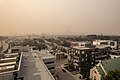 Limoilou - Fumée 06-2023.jpg 5,464 × 3,640; 4.82 MB
-
 Limoilou du haut des airs, 1948.jpg 731 × 455; 91 KB
-
 Manège militaire Voltigeurs de Québec après sa reconstruction, vue aérienne.jpg 5,284 × 3,302; 6.75 MB
-
 N023526a (1945).tif 8,426 × 6,848; 55.06 MB
-
 Place des Canotiers 02-2024 - 1.jpg 5,464 × 3,640; 4.62 MB
-
 Place des Canotiers 02-2024 - 2.jpg 5,464 × 3,640; 4.27 MB
-
 Plaines d'Abraham - Vue aérienne 2024-1.jpg 3,919 × 2,611; 3.42 MB
-
 Plaines d'Abraham - Vue aérienne 2024-2.jpg 4,046 × 2,695; 4.11 MB
-
 Quai 101 - Port de Québec.jpg 5,464 × 3,640; 6.55 MB
-
 Quartier Montcalm - Vue aerienne - 1938.jpg 1,403 × 1,114; 562 KB
-
 Quebec vers 1925.jpg 1,127 × 896; 656 KB
-
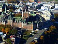 Québec City - Château Frontenac - panoramio.jpg 4,000 × 3,000; 2.9 MB
-
 Québec City - La Citadelle de Québec - Port - panoramio.jpg 4,000 × 3,000; 2.92 MB
-
 Québec City - Ville De Quebec 2 Rue des Jardins - panoramio.jpg 4,000 × 3,000; 2.45 MB
-
 Québec City – ExpoCité - Centre Vidéotron - panoramio.jpg 2,850 × 2,042; 1.36 MB
-
 Redoute Dauphine 03-2024 (1).jpg 5,304 × 3,533; 5.08 MB
-
 Redoute Dauphine 03-2024 (2).jpg 5,021 × 3,344; 5.1 MB
-
 Rue Saint-Jean - Vue aérienne 2024.jpg 5,464 × 3,640; 7.19 MB
-
 Rue Saint-Pierre Québec 02-2024 (vue aérienne).jpg 5,464 × 3,640; 5 MB
-
 Société de l'assurance automobile du Québec - Vue aérienne 03-2024.jpg 5,464 × 3,640; 3.84 MB
-
 Séminaire Rue Saint-Paul - Fumée 2023.jpg 5,464 × 3,640; 6.8 MB
-
 Vieux-Port de Québec - Fumée 2023.jpg 4,813 × 3,207; 4.34 MB
-
 Vieux-Port de Québec 03-2024.jpg 4,959 × 3,304; 5.24 MB
-
 Vieux-Québec - Fumée 2023 (2).jpg 5,043 × 3,360; 5.48 MB
-
 Vieux-Québec - Fumée 2023 (3).jpg 5,464 × 3,640; 6.39 MB
-
 Vieux-Québec - Fumée 2023.jpg 5,210 × 3,471; 5.69 MB
-
 Vieux-Québec - Vue aérienne 2024 (1).jpg 5,464 × 3,640; 6.98 MB
-
 Vue aerienne de Quebec - 1945.jpg 720 × 580; 145 KB
-
 Vue aerienne de Quebec en 1929.jpg 1,000 × 683; 147 KB
-
 Vue aerienne de Quebec en 1945.jpg 720 × 418; 88 KB
-
 Vue aerienne de Quebec vers 1925.jpg 998 × 775; 238 KB
-
 Vue aerienne est-ouest de Quebec - 1945.jpg 1,024 × 590; 388 KB
-
 Vue aérienne - Montcalm jusqu'à Sainte-Foy.jpg 5,655 × 2,882; 8.19 MB
-
 Vue aérienne - Montcalm.jpg 3,508 × 2,342; 5.21 MB
-
 Vue aérienne de Québec.tif 8,425 × 6,868; 55.18 MB
-
 Vue aérienne du quartier Limoilou en 1948 (2).tif 8,445 × 6,673; 53.74 MB
-
 Vue aérienne du quartier Limoilou en 1948.tif 8,454 × 6,683; 53.88 MB
-
 Vue aérienne du quartier Saint-Roch en 1949.tif 8,420 × 6,787; 54.53 MB
-
 Vue aérienne du quartier Saint-Roch en 1952.tif 8,364 × 6,948; 55.45 MB
-
 Vue aérienne estuaire rivière St-Charles 1937.jpg 1,024 × 738; 144 KB
-
 Église de Saint-Jean-Baptiste à Québec, vue aérienne du quartier 01.jpg 3,744 × 5,616; 10.54 MB

.jpg)
.jpg)
.jpg)


.jpg)
.jpg)
.jpg)
.jpg)


.jpg)


_-_2.jpg)


_1.jpg)
_2.jpg)


.jpg)
.jpg)

.jpg)


.jpg)
.jpg)

.jpg)


