Category:A148 road (England)
Jump to navigation
Jump to search

road in England | |||||
| Upload media | |||||
| Instance of | |||||
|---|---|---|---|---|---|
| Location |
| ||||
| Transport network |
| ||||
| Length |
| ||||
| |||||
Subcategories
This category has the following 7 subcategories, out of 7 total.
C
E
H
- Cromer Road, High Kelling (7 F)
- Cromer Road, Holt (20 F)
- Holt Bypass (1 F)
- Holt Methodist Church (5 F)
Media in category "A148 road (England)"
The following 103 files are in this category, out of 103 total.
-
 A row of cottages - geograph.org.uk - 1025695.jpg 640 × 480; 166 KB
-

-
 A148 heading towards Kings Lynn. - geograph.org.uk - 161715.jpg 640 × 481; 55 KB
-
 A148 Road sign.JPG 2,560 × 1,920; 777 KB
-
 A148 south of Sheringham - geograph.org.uk - 386836.jpg 640 × 480; 86 KB
-
 A148 UK Road.png 1,520 × 749; 14 KB
-
 All lit up - geograph.org.uk - 630602.jpg 638 × 432; 48 KB
-
 Anchorage Barn Veterinary Clinic - geograph.org.uk - 413652.jpg 640 × 480; 82 KB
-
 Approach to roundabout on the A148 - geograph.org.uk - 988885.jpg 480 × 640; 182 KB
-

-
 Aylmerton entrance sign - geograph.org.uk - 2282661.jpg 640 × 480; 59 KB
-
 Bale Safety Camera - geograph.org.uk - 1223908.jpg 640 × 480; 66 KB
-
 Bridge over the River Glaven - geograph.org.uk - 1025711.jpg 640 × 456; 132 KB
-
 Crawfish Inn, Thursford, 2009-03-09.JPG 2,560 × 1,920; 3.29 MB
-
 -2020-12-28 Place name sign, Holt Road, Cromer, Norfolk, .JPG 5,152 × 3,864; 6.18 MB
-
 -2021-10-07 Holt Road, Cromer, Norfolk.JPG 5,152 × 3,864; 7.15 MB
-
 A148 Holt Road - geograph.org.uk - 3619725.jpg 640 × 481; 55 KB
-
 A148 Into Cromer.JPG 2,560 × 1,920; 1.18 MB
-
 Carpet shop in Holt Road (A148) - geograph.org.uk - 1084855.jpg 640 × 480; 82 KB
-
 Cromer Police Station - geograph.org.uk - 1084864.jpg 640 × 480; 60 KB
-
 Cromer police station and court - geograph.org.uk - 896202.jpg 640 × 448; 104 KB
-
 Formerly Cromer Police Station - geograph.org.uk - 4063673.jpg 640 × 430; 53 KB
-
 Holt Rd - geograph.org.uk - 3835238.jpg 640 × 430; 62 KB
-
 Holt Rd, A148 - geograph.org.uk - 4063677.jpg 640 × 430; 57 KB
-
 Holt Rd, A148 - geograph.org.uk - 4063725.jpg 640 × 430; 47 KB
-
 MFI ( in administration) - geograph.org.uk - 1084856.jpg 640 × 480; 79 KB
-
 On Holt Rd - geograph.org.uk - 4060264.jpg 640 × 430; 51 KB
-
 Crossroads amidst fields - geograph.org.uk - 850551.jpg 640 × 480; 142 KB
-
 Crossroads at Stowe Ollands, Bale - geograph.org.uk - 1043940.jpg 640 × 480; 112 KB
-
 Disused railway bridge, King's Lynn harbour branch.jpg 2,388 × 1,590; 835 KB
-
 East Rudham station (remains) geograph-3447561-by-Ben-Brooksbank.jpg 2,149 × 1,313; 2.51 MB
-
 Entrance to Brookhill Farm - geograph.org.uk - 952436.jpg 480 × 640; 118 KB
-
-
 Entrance to the new Cromer town cemetery - geograph.org.uk - 614200.jpg 480 × 640; 128 KB
-

-
 Great Snoring Road - geograph.org.uk - 988904.jpg 480 × 640; 111 KB
-
 Gresham's School, Holt - geograph.org.uk - 235480.jpg 640 × 480; 106 KB
-
 Holt railway station (site), Norfolk (geograph 5017525).jpg 1,600 × 1,200; 461 KB
-
 Holt Road (A148) - geograph.org.uk - 849756.jpg 480 × 640; 143 KB
-
 A148 looking west near Holt - geograph.org.uk - 3628335.jpg 640 × 481; 57 KB
-
 A148 westbound at Holt boundary - geograph.org.uk - 3628343.jpg 640 × 480; 60 KB
-
 A148, Holt - geograph.org.uk - 3835084.jpg 640 × 430; 66 KB
-
 Houses along the A148 (Cromer Road) - geograph.org.uk - 1249136.jpg 640 × 480; 72 KB
-
 Junction of A148 with B1156.jpg 640 × 480; 55 KB
-
-

-
 Kings Lynn- where trains once crossed (geograph 5981573).jpg 1,024 × 1,024; 1.23 MB
-
 Letheringsett Hall and church - geograph.org.uk - 1025717.jpg 480 × 640; 104 KB
-
 Letheringsett Watermill and the River Glaven 22nd Oct 2007 (1).JPG 2,560 × 1,920; 1.21 MB
-
 Letheringsett Watermill and the River Glaven 22nd Oct 2007 (4).JPG 2,560 × 1,920; 1.2 MB
-
 Looking east along Cromer Road (A148) - geograph.org.uk - 642650.jpg 640 × 480; 61 KB
-
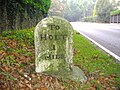
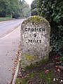
 Mile Stone - geograph.org.uk - 1223962.jpg 640 × 480; 104 KB
-
 Milestones on the A148 22nd October 2007 (2).JPG 2,560 × 1,920; 1.07 MB
-
 Milestones on the A148 22nd October 2007 (4).JPG 1,920 × 2,560; 1.02 MB
-
 Milestones on the A148 22nd October 2007 (5).JPG 1,920 × 2,560; 1.01 MB
-
 Milestones on the A148 22nd October 2007 (6).JPG 1,920 × 2,560; 1.01 MB
-
 North towards Holt Road (A148) - geograph.org.uk - 547796.jpg 480 × 640; 88 KB
-
 Ready for Christmas - geograph.org.uk - 630604.jpg 638 × 450; 48 KB
-
 River Cong (1).JPG 1,920 × 2,560; 1.08 MB
-
 Roman Camp Garage Sunday 27 June 2010 .JPG 4,000 × 3,000; 2.25 MB
-
 Safety Cameras at Bale Norfolk 22nd Oct 2007 (1).JPG 2,560 × 1,920; 1.22 MB
-
 Snow on the A148 road at Felbrigg.JPG 2,560 × 1,920; 1.16 MB
-
 South across A148 - geograph.org.uk - 1339563.jpg 640 × 480; 99 KB
-

-
 The Bus Home - geograph.org.uk - 1152845.jpg 640 × 395; 152 KB
-
 The Crawfish Inn, Thursford, 9 March 2009 (2).JPG 2,560 × 1,920; 3.21 MB
-
 The Crawfish Public House - geograph.org.uk - 1198065.jpg 640 × 480; 75 KB
-
 The Duke's Head, West Rudham - geograph.org.uk - 387879.jpg 640 × 480; 78 KB
-
 The former Letheringsett Brewery - geograph.org.uk - 1025714.jpg 640 × 467; 173 KB
-
 The Green Man pub - geograph.org.uk - 849753.jpg 640 × 480; 137 KB
-
 The Green Man Public House - geograph.org.uk - 1198081.jpg 640 × 480; 64 KB
-
 The Kings Head public house - pub sign - geograph.org.uk - 1025723.jpg 480 × 640; 169 KB
-

-
 The White Horse public house - geograph.org.uk - 1217791.jpg 640 × 480; 62 KB
-
 Tree-lined footpath to Thursford Wood - geograph.org.uk - 952402.jpg 480 × 640; 173 KB
-
 UK road A148.PNG 568 × 184; 7 KB
-
 UK Road A148.png 790 × 998; 111 KB
-

-
 View across the A148 - geograph.org.uk - 641947.jpg 480 × 640; 106 KB
-
 View across the A148 to Breck Farm - geograph.org.uk - 547776.jpg 640 × 480; 52 KB
-
 View east along the A148 (Holt Road) - geograph.org.uk - 952441.jpg 640 × 459; 106 KB
-
-
 View north towards Holt Road (A148) - geograph.org.uk - 545933.jpg 640 × 480; 78 KB
-
 View south along Great Snoring Road - geograph.org.uk - 950095.jpg 480 × 640; 201 KB
-
 View southwest along the A148 (Holt Road) - geograph.org.uk - 952438.jpg 480 × 640; 129 KB
-
 Village sign - geograph.org.uk - 1392095.jpg 428 × 639; 75 KB
-
 West along A148 - geograph.org.uk - 456598.jpg 640 × 480; 95 KB
-
 A colourful fence post - geograph.org.uk - 950552.jpg 480 × 640; 199 KB
-
 A148 - geograph.org.uk - 417137.jpg 640 × 480; 70 KB
-
 A148 heading out of King's Lynn, Norfolk. - geograph.org.uk - 285792.jpg 640 × 480; 111 KB
-
 A148. - geograph.org.uk - 285796.jpg 640 × 480; 125 KB
-

-
 Cat and Fiddle, East Rudham - geograph.org.uk - 387970.jpg 640 × 480; 83 KB
-
-
 Former Route of the A148 - geograph.org.uk - 549692.jpg 640 × 426; 86 KB
-
 House on Holt Road, A148 - geograph.org.uk - 386859.jpg 640 × 429; 118 KB
-
 Junction of Upper Hall Road with A148 - geograph.org.uk - 529808.jpg 640 × 480; 56 KB
-
 Junction with the A148 (Holt Road) - geograph.org.uk - 547792.jpg 640 × 480; 59 KB
-
 Lay-by off A148, Dunton Patch - geograph.org.uk - 401439.jpg 640 × 480; 93 KB
-

-

-
-


_-_geograph.org.uk_-_1084855.jpg)


_-_geograph.org.uk_-_1084856.jpg)


_geograph-3447561-by-Ben-Brooksbank.jpg)


_-_geograph.org.uk_-_1025690.jpg)


,_Norfolk_(geograph_5017525).jpg)
_-_geograph.org.uk_-_849756.jpg)


_-_geograph.org.uk_-_1249136.jpg)


.jpg)

.JPG)
.JPG)
_-_geograph.org.uk_-_642650.jpg)

.JPG)
.JPG)
.JPG)
.JPG)
_-_geograph.org.uk_-_547796.jpg)

.JPG)

.JPG)


_past_the_Letheringsett_Brewery_-_geograph.org.uk_-_1025693.jpg)

.JPG)


_-_geograph.org.uk_-_540589.jpg)


_-_geograph.org.uk_-_850552.jpg)


_-_geograph.org.uk_-_952441.jpg)

_-_geograph.org.uk_-_545933.jpg)

_-_geograph.org.uk_-_952438.jpg)


_-_geograph.org.uk_-_547792.jpg)

_-_geograph.org.uk_-_545924.jpg)
_past_Laurel_Farm_Cottages_-_geograph.org.uk_-_540597.jpg)
_with_view_towards_junction_with_Briton%27s_Lane_-_geograph.org.uk_-_540612.jpg)
_near_Laurel_Farm_-_geograph.org.uk_-_540600.jpg)