Category:2010s maps of Iraq
Jump to navigation
Jump to search
Subcategories
This category has the following 5 subcategories, out of 5 total.
- 2014 maps of Iraq (26 F)
- 2017 maps of Iraq (10 F)
Media in category "2010s maps of Iraq"
The following 14 files are in this category, out of 14 total.
-
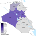
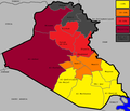
2010 Iraqi election map.png 1,262 × 1,086; 62 KB
-
2010 Iraqi election map.svg 1,241 × 1,264; 314 KB
-
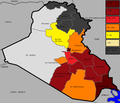
2013 Iraqi governorate election status.svg 1,241 × 1,264; 313 KB
-
2013 Iraqi governorate elections-ar.svg 1,241 × 1,264; 443 KB
-
2013 Iraqi governorate elections.svg 1,241 × 1,264; 313 KB
-
2014 Iraqi election map ar.svg 1,241 × 1,264; 331 KB
-
2014 Iraqi election map.svg 1,241 × 1,264; 328 KB
-
2014 Iraqi Election.svg 512 × 419; 142 KB
-
Azem2021.svg 1,241 × 1,264; 319 KB
-
Iraqi Deaths in 2012 - By Province, Per 100,000 People-ar.png 700 × 712; 192 KB
-
Iraqi election 2010 map-ar.svg 1,262 × 1,086; 302 KB
-
Iraqiya 2010.png 1,260 × 1,084; 61 KB
-
Sinjar offensive map.png 1,362 × 1,005; 779 KB
-
Stateoflaw2009.png 1,260 × 1,084; 63 KB


