Category:1922 maps of Africa
Jump to navigation
Jump to search
Temperate regions: North America · South America · Africa · Europe · Asia · – Polar regions: – Other regions:
| ← 1920 1921 1922 1923 1924 1925 1926 1927 1928 1929 → |
Media in category "1922 maps of Africa"
The following 19 files are in this category, out of 19 total.
-
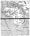
Carte d'ensemble de l'Afrique, par Delafosse, 1922.jpg 868 × 1,045; 431 KB
-
Carte de l'Afrique centrale et orientale, par Delafosse, 1922.jpg 1,207 × 858; 416 KB
-
Carte de l'Afrique occidentale, par Delafosse, 1922.jpg 1,202 × 866; 422 KB
-
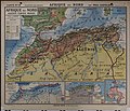
Afrique du Nord - par Paul Castelnau... - btv1b525059404 (1 of 2).jpg 19,228 × 16,428; 43.68 MB
-
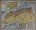
Afrique du Nord - par Paul Castelnau... - btv1b525059404 (2 of 2).jpg 19,328 × 16,085; 42.61 MB
-
Afrique politique... - par J. Forest... - btv1b53065279g.jpg 12,268 × 15,696; 33.9 MB
-
Map of Africa (2674833839).jpg 1,804 × 2,000; 3.63 MB
-
Map of Africa (2674833839)c.jpg 1,704 × 1,887; 1.99 MB
-
Substances minérales utiles de l'Afrique occidentale - par Henry Hubert - btv1b530652586.jpg 11,096 × 7,616; 9.29 MB
-
The agricultural and forest products of British West Africa; (1922) (17941889892).jpg 3,120 × 1,898; 1.48 MB
-
The agricultural and forest products of British West Africa; (1922) (17945019825).jpg 1,762 × 2,930; 1.09 MB
-
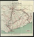
The National Archives UK - CO 1069-42-89.jpg 945 × 1,024; 568 KB


