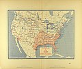
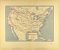
Category:1894 maps of the United States
Jump to navigation
Jump to search
States of the United States: California · Connecticut · Illinois · Iowa · Kansas · Maryland · Michigan · Minnesota · Mississippi · Missouri · Montana · New York · North Carolina · Ohio · Oklahoma · Oregon · Pennsylvania · South Carolina · South Dakota · Tennessee · Texas · Virginia · Washington · West Virginia · Wisconsin · Wyoming – Washington, D.C.
Subcategories
This category has the following 29 subcategories, out of 29 total.
C
- 1894 maps of Connecticut (2 F)
D
I
K
- 1894 maps of Kansas (empty)
M
N
O
- 1894 maps of Oregon (4 F)
P
S
T
- The Universal atlas 1894 (37 F)
V
W
Media in category "1894 maps of the United States"
The following 17 files are in this category, out of 17 total.
-
A course in civil government (1894) (14764433221).jpg 2,708 × 3,108; 1.9 MB
-
Absolute Humidity for July 1876-1886 Map.jpg 3,489 × 2,930; 2.24 MB
-
Average Date of First Killing Frost.jpg 2,955 × 2,195; 1.65 MB
-
Average Date of Last Killing Frost.jpg 2,958 × 2,264; 1.74 MB
-
Journal of the Academy of Natural Sciences of Philadelphia (1894) (14781353355).jpg 2,642 × 3,360; 638 KB
-
Map of the American East.jpg 2,931 × 3,501; 2.49 MB
-
Map of the American West.jpg 2,932 × 3,476; 2.22 MB
-
Map showing Indian reservations within the limits of the United States, 1894.jpg 3,857 × 2,547; 2.95 MB
-
Maximum temperature map of the United States.jpg 3,495 × 2,938; 2.16 MB
-
McKee's Correct Road Map of Seattle and Vicinity, 1894 (MOHAI 13401).jpg 870 × 1,200; 153 KB
-
Minimum temperature map of the United States.jpg 3,477 × 2,936; 2.1 MB
-
Map of the U. S. and Territories…North Central (NYPL b18036847-psnypl map 300).jpg 4,536 × 5,360; 7.25 MB
-
Map of the U. S. and Territories…North Central (NYPL b18036847-psnypl map 300).tiff 4,854 × 5,782; 80.3 MB
-
Map of the U. S. and Territories…North East (NYPL b18036847-psnypl map 299).jpg 4,600 × 5,352; 6.1 MB
-
Map of the U. S. and Territories…North East (NYPL b18036847-psnypl map 299).tiff 4,854 × 5,782; 80.3 MB


