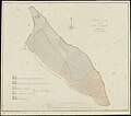
Category:1820s maps of Aruba
Jump to navigation
Jump to search
Media in category "1820s maps of Aruba"
The following 4 files are in this category, out of 4 total.
-
BNA-DIG-MAPA-SPENGLER-RADERS-1825-001 resized.jpg 4,000 × 2,683; 1.85 MB
-
Erfgoed kaart.jpg 6,204 × 5,072; 21.71 MB
-
Het eiland aruba. Hooy berg.jpg 5,754 × 4,060; 2.08 MB
-
NL-HaNA 4.MIKO 308-groot.jpg 5,399 × 4,758; 1.21 MB


