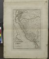
Category:1810s maps of Peru
Jump to navigation
Jump to search
Media in category "1810s maps of Peru"
The following 5 files are in this category, out of 5 total.
-
Peru (NYPL b15376638-1404016).tiff 5,248 × 6,299; 94.6 MB
-
1818 Pinkerton Map of Peru - Geographicus - Peru-pinkerton-1818.jpg 6,000 × 4,393; 6.5 MB
-
Peru, Chili and La Plata (4583424099).jpg 1,505 × 2,000; 2.64 MB
-
Puente del Inca Mapa 1811.jpg 3,264 × 2,448; 3.54 MB
-
Péru, Chili and La Plata - btv1b530291439.jpg 6,732 × 8,719; 9.06 MB


