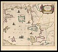
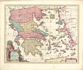
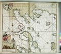
Category:17th-century maps of the Aegean Sea
Jump to navigation
Jump to search
Subcategories
This category has only the following subcategory.
1
Media in category "17th-century maps of the Aegean Sea"
The following 85 files are in this category, out of 85 total.
-
Map of Greece(1600) south east.jpg 800 × 600; 165 KB
-
1600 map of the Aegean Sea, Greece, and Western Asia Minor.tif 4,416 × 3,296; 9.01 MB
-
Eastern Mediterranean RMG C4572 2.tiff 4,776 × 2,946; 40.26 MB
-
UBBasel Map 1601 Kartenslg AA 89a-c Graecia.tiff 14,042 × 6,362, 4 pages; 650.09 MB
-
1601 map of today's Turkey and Greece by Abraham Ortelius.tif 7,911 × 5,815; 263.25 MB
-
Greek Archipelago RMG C4573 1.tiff 3,013 × 4,543; 39.16 MB
-
Greek Archipelago RMG F1946.tiff 7,055 × 4,993; 100.78 MB
-
Carte de la Mer Égée - btv1b5901114b (1 of 3).jpg 7,935 × 7,057; 6.01 MB
-
Greek Archipelago RMG F1950.tiff 7,238 × 4,936; 102.22 MB
-
1624 - Carte de la Mer Egée et de la Mer de Marmara.jpg 10,438 × 17,120; 26.66 MB
-
Taboas geraes de toda a navegação LOC 78653638-24.jpg 9,414 × 5,570; 5.54 MB
-
Taboas geraes de toda a navegação LOC 78653638-24.tif 9,414 × 5,570; 150.02 MB
-
1640 Portolan chart of the Aegean Sea by Giovanni Battista Cavallini.tif 8,893 × 5,317; 135.3 MB
-
Greek Archipelago RMG F1801.tiff 7,675 × 4,686; 102.9 MB
-
Greek Archipelago RMG S0018.jpg 1,280 × 811; 1.43 MB
-
Ca. 1645 map of Greece by Johannes et Cornelis Blaeu.jpg 13,348 × 10,534; 26.66 MB
-
Atlas de la Méditerranée - Petrus Collin - btv1b55007092q (10 of 17).jpg 13,283 × 9,602; 19.2 MB
-
1646 map of the Eastern Mediterranean by Robert Dudley.pdf 2,285 × 3,068; 1.01 MB
-
1646 map of the Aegean Sea by Robert Dudley.pdf 4,454 × 2,952; 1.89 MB
-
1649-1660-oт Амстердам Йоан Янссониус-Малоазийска Мизия и Троя-12837-мизомакедони-01.jpg 1,276 × 1,076; 631 KB
-
Hellas seu Graecia Universa - autore J. Laurenbergio - btv1b53036599v.jpg 7,566 × 6,366; 7.93 MB
-
Hellas seu Graecia Universa - autore J. Laurenbergio - btv1b5962159w.jpg 6,984 × 5,936; 6.02 MB
-
Map - Special Collections University of Amsterdam - OTM- HB-KZL 33.07.63.tif 7,319 × 5,897; 123.48 MB
-
A-3-37-67-Greece-Islands.jpg 3,000 × 2,213; 773 KB
-
Atlas nautique de la Mer Méditerranée - btv1b59010993 (4 of 9).jpg 7,357 × 5,238; 4.6 MB
-
Atlas nautique de la Mer Méditerranée - btv1b59011009 (2 of 6).jpg 7,459 × 4,908; 4.45 MB
-
Atlas nautique de la Mer Méditerranée - btv1b5901101q (4 of 7).jpg 7,574 × 5,322; 4.63 MB
-
Atlas nautique de la Mer Méditerranée - signé G. B. - btv1b5901112h (06 of 10).jpg 5,322 × 3,452; 2.37 MB
-
Carte de la Mer Egée - btv1b59011024 (1 of 3).jpg 7,884 × 5,532; 4.75 MB
-
1662 Portolan chart of the Aegean Sea and the Dardanelles by François Ollive.jpg 7,357 × 5,238; 4.75 MB
-
1662 Portolan chart of the Aegean Sea and the Sea of Marmara by François Ollive.jpg 5,322 × 3,452; 2.47 MB
-
1662 Portolan chart of the Aegean Sea by François Ollive.jpg 7,884 × 5,532; 4.93 MB
-
1660 Portolan chart of the Aegean Sea and the Sea of Marmara by Jean-François Roussin.jpg 7,962 × 5,733; 5.41 MB
-
Cyclades Insvlæ - Atlas Maior, vol 2, map 38 - Joan Blaeu, 1667 - BL 114.h(star).2.(38).jpg 4,000 × 3,362; 2.04 MB
-
Maris Ægaei - Atlas Maior, vol 2, map 39 - Joan Blaeu, 1667 - BL 114.h(star).2.(39).jpg 4,000 × 3,409; 2.04 MB
-
John Speed - Map of Greece.jpg 12,456 × 9,796; 26.3 MB
-
Map - Special Collections University of Amsterdam - OTM- HB-KZL 33.05.66.tif 7,451 × 6,379; 135.98 MB
-
Sjökort-Sjökort över Egeiska havet. Grekland, Turkiet (Anatolien) och Kreta (Candia) syns - Sjöhistoriska museet - 2007-006-25.tif 4,724 × 3,307, 2 pages; 22.76 MB
-
Archipelagusche eylanden RMG F8162.tiff 4,980 × 4,452; 63.43 MB
-
Archipelagusche eylanden RMG F8163.tiff 5,010 × 4,479; 64.2 MB
-
Archipelagusche eylanden RMG F8164.tiff 5,040 × 4,506; 64.97 MB
-
1685 map of the Aegean Sea by Giacomo Cantelli da Vignola.jpg 3,776 × 4,601; 3.22 MB
-
Archipelagus - Enderlin Jacob - 1686.jpg 2,112 × 1,771; 2.04 MB
-
Map of the Aegean Sea - Piacenza Francesco - 1688.jpg 1,034 × 1,500; 912 KB
-
1689 map of Greece by Giacomo Cantelli da Vignola.jpg 4,717 × 3,696; 3.34 MB
-
Atlante Veneto Volume 1 110.jpg 9,808 × 6,452; 6.62 MB
-
Atlante Veneto Volume 2 057.jpg 10,290 × 7,037; 8.08 MB
-
Atlante Veneto Volume 2 064.jpg 10,359 × 7,001; 7.53 MB
-
Atlante Veneto Volume 2 065.jpg 10,359 × 7,072; 6.36 MB
-
ΕΛΛΑΣ, seu Graecia universa - autore J. Laurenbergio - btv1b53036653w.jpg 7,426 × 6,040; 6.6 MB
-
Atlas de la Méditerranée (Reproduction numérique) - s.n. - btv1b53028102v (04 of 11).jpg 6,128 × 7,781; 8.67 MB
-
Admiralty Chart No 1684 Mirtoon Pelagos with Lakonikos Kolpos, Published 1969.jpg 18,432 × 11,297; 34.89 MB
-
Aegean Sea by Jean Francois Roussin, Venice 1661.jpg 467 × 640; 221 KB
-
Aegean Sea, Olfert Dapper, 1688.JPG 1,438 × 1,146; 538 KB
-
Essai carte ancienne.jpg 1,800 × 1,234; 1.64 MB
-
Map - Special Collections University of Amsterdam - OTM- HB-KZL 33.05.61.tif 7,551 × 6,469; 139.75 MB
-
Map - Special Collections University of Amsterdam - OTM- HB-KZL 33.05.63.tif 7,422 × 6,040; 128.26 MB
-
Map - Special Collections University of Amsterdam - OTM- HB-KZL 33.05.69.tif 6,944 × 5,829; 115.8 MB
-
Map - Special Collections University of Amsterdam - OTM- HB-KZL 33.06.04.tif 6,808 × 5,684; 110.71 MB


