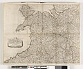
Category:1640s maps of Wales
Jump to navigation
Jump to search
Media in category "1640s maps of Wales"
The following 6 files are in this category, out of 6 total.
-
Anglia Regnum - btv1b530562587 (1 of 2).jpg 6,016 × 4,768; 4.94 MB
-
The mappe of Shropshire Cheshire Staffordshire, Worcestershire... (BM 1856,0209.18).jpg 2,500 × 2,074; 1.28 MB
-
Atlas Van der Hagen-KW1049B11 031-WALLIA PRINCIPATUS Vulgo WALES..jpeg 5,500 × 4,325; 2.87 MB
-
Principatus Walliae pars australis - vulgo South-Wales - btv1b530563914 (1 of 2).jpg 6,560 × 5,200; 5.61 MB


